Mont Mounier, Mountain summit in Alpes-Maritimes, France
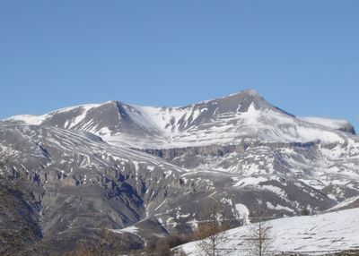
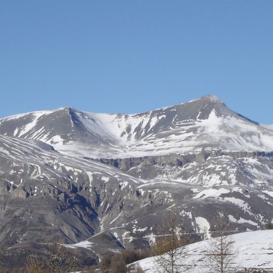
Mont Mounier is a 2817-metre summit in the Maritime Alps at Beuil, Alpes-Maritimes, within Mercantour National Park. Its rounded top ends in a slightly higher point on the right; below it a band of pale grey Tithonian limestone cliffs runs across the mountain in vertical columns, and the lower slopes fall away in eroded rock and snow-filled gullies.
An astronomical observatory was built on the peak in 1893 to study celestial objects from this high elevation. This facility made the mountain an important research location for astronomers of that era.
The name Mont Mounier means "black mountain", referring to the dark marls of its upper slopes. The summit is marked by the stèle Vallette, a memorial to Lieutenant Vallette, who died there in fog after falling into the south-west rock face. The GR5 long-distance path and the Via Alpina's Blue Route cross the Col de Crousette below the peak.
Access routes converge at the Vallette stele (2,585 m), reached from Roya via the Col de Crousette (2,480 m) on the GR5, from Valberg via the Col de l'Espaul (1,748 m), or from Beuil via the Col des Moulines (1,981 m). From the stele a single crest path leads over the Petit Mounier (2,727 m) to the summit, about 1,100 m of ascent. The lieutenant Vallette died falling in the southwest wall here in fog; the final ridge calls for care.
On clear days, the summit offers views of the Mediterranean Sea and the island of Corsica stretching across the horizon. Looking northward, visitors can see the higher peaks of the main Alpine range rising further away.
The community of curious travelers
AroundUs brings together thousands of curated places, local tips, and hidden gems, enriched daily by 93,547 contributors worldwide.