Climont, Mountain summit in Bas-Rhin, France
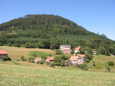
Climont is a mountain summit in the Vosges at 965 meters elevation, distinguished by its striking trapezoidal sandstone formation. The peak rises noticeably above the surrounding forested valleys and creates a recognizable landmark across the region.
The mountain was previously known as Clivemont or Winberg and served as an important landmark along historic trade routes crossing the Vosges region. Its different names and evolving uses reflect centuries of activity by merchants and travelers passing through the area.
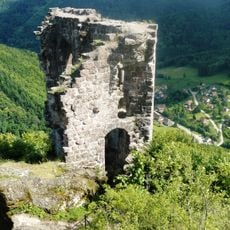
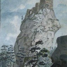
The Julius Tower at the summit commemorates Julius Euting, who established the Vosges Club and developed the regional hiking trail network.
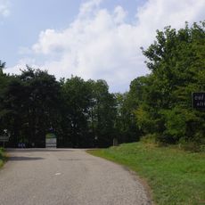
Marked hiking trails approach the summit from nearby communities, with good infrastructure around Urbeis for starting your walk. Plan your visit according to season and weather conditions, as mountain paths can vary significantly depending on time of year.
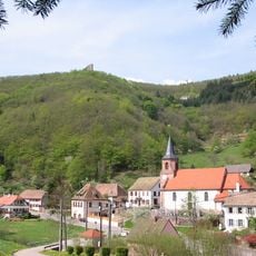
An observation tower at the summit offers a complete 360-degree panoramic view across the entire Val de Villé valley and the surrounding mountain chains. This vantage point lets visitors see the entire landscape from a single location.
Location: Bas-Rhin
Elevation above the sea: 965 m
GPS coordinates: 48.34486,7.18327
Latest update: December 12, 2025 07:51
Château de Bilstein
3.3 km
Château de la Roche
6.2 km
Honcourt Abbey
7.4 km
Col de Fouchy
7.2 km
Mine Haus Österreich
5.9 km
Chapelle du cimetière de Steige
4.6 km
Église Saint-Nicolas de Colroy-la-Roche
4.9 km
Église Saint-André de Blancherupt
6.9 km
Église Saint-Blaise de Saint-Blaise-la-Roche
6.8 km
Église Sainte-Madeleine de Steige
4.4 km
Église Saint-Michel de Saulxures
6.5 km
Église Saint-Antoine de Maisonsgoutte
6.1 km
Temple du Climont
708 m
Église évangélique mennonite de Bourg-Bruche
3.7 km
Église Saint-Quirin de Bassemberg
7.5 km
Église Saint-Barthélemy de Saales
5.7 km
Église Saint-Nicolas d'Urbeis
3.6 km
Église Saint-Pierre de Bourg-Bruche
3.9 km
Église Saint Jean-Baptiste
6.7 km
Église Saint-Vincent de Ranrupt
3.5 km
Église Saint-Jean-Baptiste de Colroy-la-Grande
6.2 km
Église luthérienne de Bellefosse
6.9 km
Chapelle de la Jambe-de-Fer de la forêt domaniale de Colroy-Lubine
4.2 km
Église de la Pentecôte de Lubine
3.9 km
Chapelle protestante de Saales
5.4 km
Chapelle Notre-Dame-du-Bon-Secours de Sainte-Croix-aux-Mines
7.4 km
Chapelle Notre-Dame-Auxiliatrice de Noirceux
6.6 km
Chapelle Sainte-Barbe de Saales
5.8 kmVisited this place? Tap the stars to rate it and share your experience / photos with the community! Try now! You can cancel it anytime.
Discover hidden gems everywhere you go!
From secret cafés to breathtaking viewpoints, skip the crowded tourist spots and find places that match your style. Our app makes it easy with voice search, smart filtering, route optimization, and insider tips from travelers worldwide. Download now for the complete mobile experience.
A unique approach to discovering new places❞
— Le Figaro
All the places worth exploring❞
— France Info
A tailor-made excursion in just a few clicks❞
— 20 Minutes