Mount Aiguille

Log in to your account

AroundUs is a community-driven map of interesting places, built by curious explorers like you. It grows with every review, story, and photo you share.
Connect to save your favorite spots, contribute locations, and create personalized routes.
By continuing, you accept our Terms and Conditions and our Privacy Policy

Mount Aiguille

Add to collection
Map
Suggest a change
Share

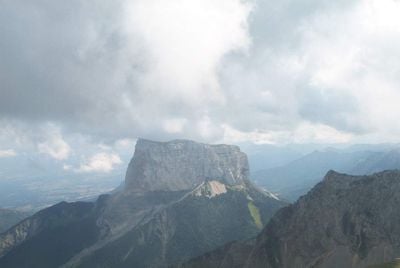
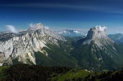
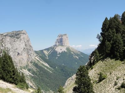
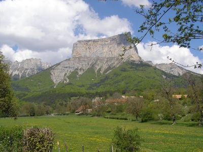
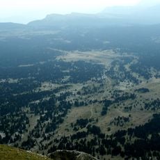
Mount Aiguille, Limestone summit in Vercors Regional Natural Park, France

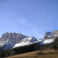
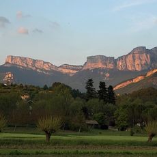
Mount Aiguille is a limestone peak in the French Prealps standing at approximately 2100 meters with steep vertical cliffs that create a distinctive flat-topped platform. Its isolated position within the Vercors mountain range makes it a striking geological formation visible from great distances.

The first recorded technical mountain climb in history took place here in 1492 when King Charles VIII of France ordered an expedition to the summit. This pioneering ascent marked the beginning of modern mountaineering and established the peak as a milestone in climbing history.

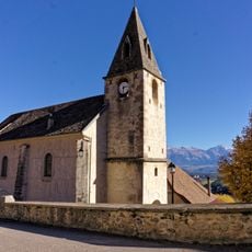
This limestone peak holds a place among the Seven Wonders of Dauphiné, representing the natural heritage of the Isère region. Visitors recognize it as an iconic symbol of the dramatic mountain landscape that defines southeastern France.

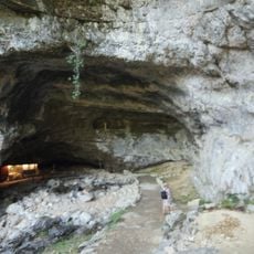
The main climbing route ascends the northeast face through a series of chimneys and ledges covering roughly 300 meters of vertical gain. You need proper climbing gear and experience with rock scrambling, as exposed passages and slippery sections are common, especially after rain.

In 1957, pilot Henri Giraud accomplished a remarkable landing on the summit using a small aircraft and a temporary runway constructed on the flat top. This audacious feat remains one of the most daring aeronautical experiments ever conducted on an Alpine peak.

Location: Chichilianne

Elevation above the sea: 2,087 m

Made from material: limestone

Part of: Seven Wonders of Dauphiné

Address: Mont Aiguille, 38930 Saint-Martin-de-Clelles, France

Website: http://montaiguille.free.fr

GPS coordinates: 44.84179,5.55222

Latest update: December 6, 2025 16:01

Photos
Notable rock formations in France

France displays a range of geological formations shaped by millions of years of natural processes. White chalk cliffs mark the northern coast, including the cliffs of Étretat and the rock of Mont Saint-Michel in Normandy. In southern regions, deep limestone gorges cut through the landscape, while...

Natural sites of the Alps: lakes, gorges, and peaks to discover

The Alps offer a wide range of natural landscapes. You find mountain lakes with clear waters, like the Eibsee in Bavaria or the Sorapis Lake in the Dolomites, gorges carved by torrents like the Partnach Gorge or the Cirque of Sixt-Fer-à-Cheval, and stunning rocky peaks such as the Tre Cime di...

Reviews

Visited this place? Tap the stars to rate it and share your experience / photos with the community! Try now! You can cancel it anytime.

« Mount Aiguille - Limestone summit in Vercors Regional Natural Park, France » is provided by Around Us (aroundus.com). Images and texts are derived from Wikimedia project under a Creative Commons license. You are allowed to copy, distribute, and modify copies of this page, under the conditions set by the license, as long as this note is clearly visible.

Discover hidden gems everywhere you go!

From secret cafés to breathtaking viewpoints, skip the crowded tourist spots and find places that match your style. Our app makes it easy with voice search, smart filtering, route optimization, and insider tips from travelers worldwide. Download now for the complete mobile experience.

Around Us App Screenshot

A unique approach to discovering new places

Le Figaro

All the places worth exploring

France Info

A tailor-made excursion in just a few clicks

20 Minutes