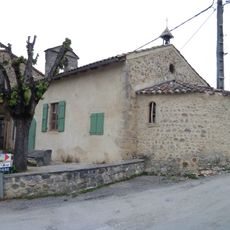
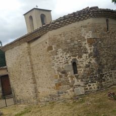
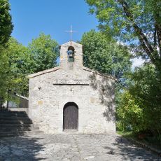
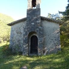
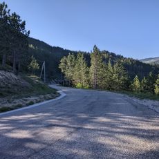
Diois, Mountain range in Drôme department, France
Description
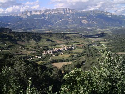
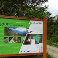
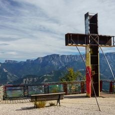
The Diois is a mountain region in the Drôme department with limestone peaks stretching from Saillans to Col de Rousset. The landscape comprises multiple valleys with natural caves and reaches heights of around 2000 meters at its highest points.
History
The area was inhabited in ancient times by the Vocontii, a Gallic people who adapted to Roman rule. Their main settlement, Die, became known as Civitas Diensis and remained significant throughout the Roman period.
Culture
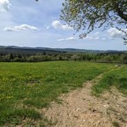
Local communities have long depended on sheep herding and cultivating aromatic herbs like lavender and thyme across the slopes. These farming practices shape how villages are organized and how people interact with the landscape today.
Practical
Multiple hiking trails cross the region, linking small valleys and connecting to cave entrances for exploration. Sturdy footwear is essential, and visitors should prepare for changing mountain weather that can shift quickly throughout the day.
Did you know?
The region became a habitat for wild wolves that returned in the 1990s after decades of absence. Alongside Alpine chamois, roe deer, and numerous bird species, this landscape has undergone a natural shift in how predators and prey interact.
AroundUs brings together thousands of curated places, local tips, and hidden gems, enriched daily by 60,000 contributors worldwide. Discover all places nearby (France).
France has entire territories that remain outside the usual tourist circuits. This collection brings together natural regions where life follows its own rhythm, away from the bustle of mainstream destinations. Here you find forested mountains like Morvan and the Vosges, volcanic plateaus in Cantal...
La Ferme aux Papillons
8.6 km
Réserve naturelle régionale de la grotte des Sadoux
7.2 kmGrotte d'Antonnaire
3.7 km
La Croix de Justin
8.7 km
Église de Saint-Benoit-en-Diois
4.8 km
Église Saint-Pierre-ès-Liens de Pradelle
7.3 km
Chapelle du cimetière de Savel
3.6 km
Église Sainte-Anne de Barsac
8 km
Église Sainte-Anne de Montlaur-en-Diois
8.3 km
Église Saint-Roman de Saint-Roman
8.3 kmLa Servelle
8.7 kmChamp Rabi
9.3 km
Chapelle Saint-Moirans de Chastel-Arnaud
8.7 km
Temple de Pennes-le-Sec
3.4 km
Chapelle Notre-Dame de l'Aribat
8.9 kmMontagne de la Cervelle
8.8 kmChâteau de la Salle
6.5 km
Borne routière (borne milliaire) à Barsac
8 km
Col de Tavard
6.1 kmScenic viewpoint
2 kmScenic viewpoint
3 kmWork of art
9.2 kmStatue, Work of art
6.7 kmScenic viewpoint
9.2 kmRuins
8.2 kmMémorial d’Espenel
8.8 kmMemorial
3.1 kmWayside cross
4.8 kmDiscover hidden gems everywhere you go!
From secret cafés to breathtaking viewpoints, skip the crowded tourist spots and find places that match your style. Our app makes it easy with voice search, smart filtering, route optimization, and insider tips from travelers worldwide. Download now for the complete mobile experience.
A unique approach to discovering new places❞
— Le Figaro
All the places worth exploring❞
— France Info
A tailor-made excursion in just a few clicks❞
— 20 Minutes