Enable Location

We need your location to show you interesting places around you

Discover nearby places

Find interesting locations and hidden gems around you

Precise directions

Get accurate directions and distances to places

Your location is never shared with other users. It's only used when you tap the location button.

Cham des Bondons

Log in to your account

Start exploring — it's free

Trusted by 61,927 travelers worldwide

Continue with Google
Continue with Apple
or

We will send you a code to connect

By continuing, you accept our Terms and Conditions and our Privacy Policy

Check your inbox

We've sent a pincode in your inbox. Please enter the code below.

Cham des Bondons

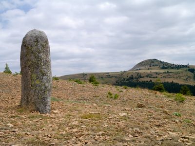
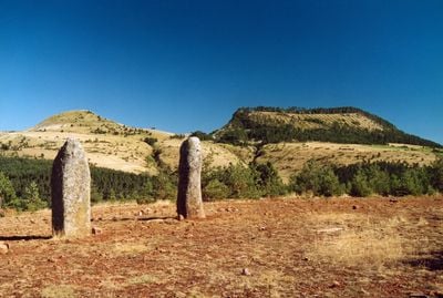
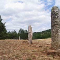
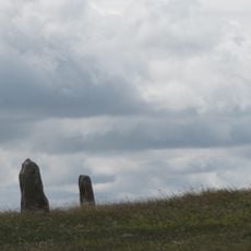
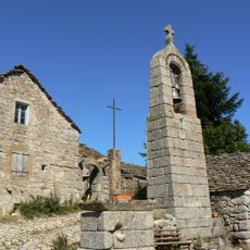
Cham des Bondons, Neolithic menhir site in Les Bondons, France.

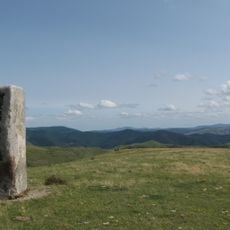
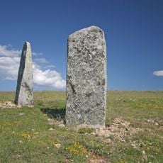
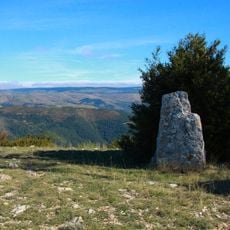
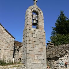
Cham des Bondons is a Neolithic open-air site on a limestone plateau at 1,100 meters elevation, featuring more than 150 granite standing stones spread across the landscape. The stones rise from the ground to form a scattered network of upright monuments that visitors can see and walk among.

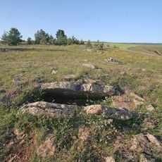
The stones were erected between the late Neolithic and Bronze Age, showing how long people used this location for ritual or community purposes. In the 1940s, a doctor named Morel made the first systematic study of the site, recording where each menhir stood.

The stones have carried different names through the centuries, from "Pierres branlantes" to "Menhirs," reflecting how local people understood them over time. Visitors today come to explore what these monuments meant to the communities that placed them on this high plateau.

Visitors can follow marked paths to explore the stones at their own pace and see different areas of the plateau. The terrain is open and fairly level, but sturdy walking shoes and weather protection are helpful at this elevation.

Each stone was transported from granite quarries near Fontpadelle, showing the enormous effort ancient people invested in building these monuments. The largest examples tower more than 4 meters above the ground.

The community of curious travelers

AroundUs brings together thousands of curated places, local tips, and hidden gems, enriched daily by 60,000 contributors worldwide.

Start exploring
Location
GPS coordinates
44.40000,3.60000
Latest update
December 8, 2025 20:02
« Cham des Bondons - Neolithic menhir site in Les Bondons, France » is provided by Around Us (aroundus.com). Images and texts are derived from Wikimedia project under a Creative Commons license. You are allowed to copy, distribute, and modify copies of this page, under the conditions set by the license, as long as this note is clearly visible.

Discover hidden gems everywhere you go!

From secret cafés to breathtaking viewpoints, skip the crowded tourist spots and find places that match your style. Our app makes it easy with voice search, smart filtering, route optimization, and insider tips from travelers worldwide. Download now for the complete mobile experience.

Around Us App Screenshot

A unique approach to discovering new places

Le Figaro

All the places worth exploring

France Info

A tailor-made excursion in just a few clicks

20 Minutes

Around Us
Travel Guide & Maps
Download

Send to your phone

QR Code
1

Open the camera app on your mobile.

2

Point at the QR code with your camera. A notification will appear.

3

Tap the notification to open the link.