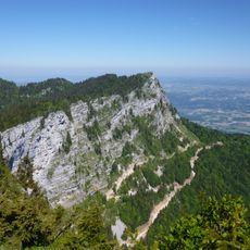
Dent de Moirans, Mountain summit in Isère department, France
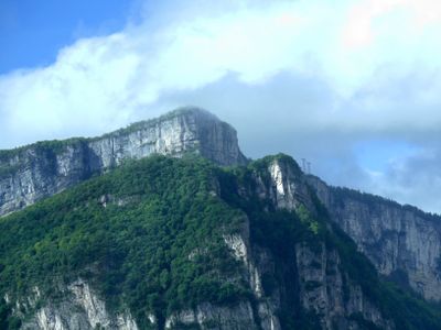
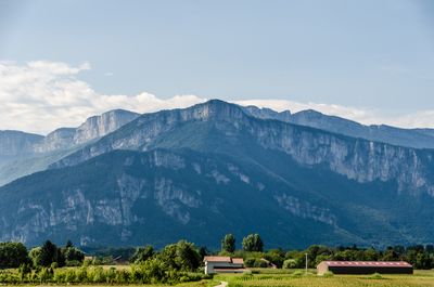
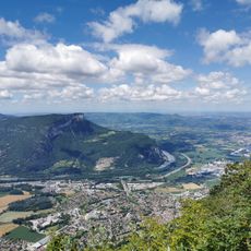
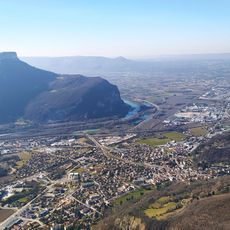
Dent de Moirans is a limestone summit located between several villages in the Isère region and shaped by natural erosion over time. The peak rises as a distinct elevation and offers views across the surrounding valleys and slopes.
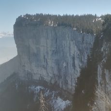
The summit was formed through geological forces and water erosion that reshaped the original mountain structure over millions of years. The rock layers visible today come from a distant prehistoric period.
The summit serves as a familiar landmark for nearby communities and shapes how people experience the surrounding landscape during outdoor activities. Local trail networks are marked using a standardized system that helps visitors navigate the routes independently.
The summit is accessible to hikers via marked trails that start from nearby villages and offer different difficulty levels for various skill levels. Visitors should wear sturdy footwear and bring appropriate gear while being prepared for mountain weather conditions.
The summit displays rock formations that are geologically distinct from typical Alpine characteristics, making it unusual from a geological perspective. Hikers can observe these distinctive layered rocks while ascending and see how they differ from surrounding peaks.
Location: Isère
Elevation above the sea: 988 m
Made from material: limestone
GPS coordinates: 45.28743,5.59566
Latest update: December 14, 2025 13:06
Monastère de Chalais
6.3 km
Château de Chaulnes
6.6 km
La Sure
5.8 km
Château de Sieyes
3.4 kmÉglise Saint-Didier de Voreppe
3.5 km
Château de la Motte
5.8 km
Église Saint-Pierre de Moirans
4.9 km
La Buffe
4.9 km
Église Saint-Vincent de Voreppe
4.4 km
Aiguille de Chalais
5.1 km
Couvent des Cordeliers de Moirans
4.9 km
Tour des Templiers
2.4 km
Le Wedge
3.1 km
Église prieurale Saint-Didier de Voreppe
3.7 km
Église Saint-Martin de La Buisse
5.7 km
Belvédère du Crochet
4.2 km
Église Saint-Martin de Mont-Saint-Martin
6.4 km
Église Saint-Vincent de Fontanil-Cornillon
6.4 km
Cadran solaire
6.4 km
Église Saint-Celse-et-Saint-Nazaire de Saint-Quentin-sur-Isère
3.8 km
Église de la Conversion-de-Saint-Paul de Noyarey
5 km
Église Saint-Jean de Saint-Jean-de-Moirans
6 km
Église de la Nativité-de-Notre-Dame de Pommiers-la-Placette
5.9 km
Église Sainte-Madeleine de Montaud
3.8 km
Église Saint-Pierre et Saint-Paul de Moirans
4.8 km
Église Saint-Georges de Veurey-Voroize
2.3 km
Établissement gallo-romain de La Buisse
5.6 km
Chapelle du Palluel de Fontanil-Cornillon
6.5 kmVisited this place? Tap the stars to rate it and share your experience / photos with the community! Try now! You can cancel it anytime.
Discover hidden gems everywhere you go!
From secret cafés to breathtaking viewpoints, skip the crowded tourist spots and find places that match your style. Our app makes it easy with voice search, smart filtering, route optimization, and insider tips from travelers worldwide. Download now for the complete mobile experience.
A unique approach to discovering new places❞
— Le Figaro
All the places worth exploring❞
— France Info
A tailor-made excursion in just a few clicks❞
— 20 Minutes