Enable Location

We need your location to show you interesting places around you

Discover nearby places

Find interesting locations and hidden gems around you

Precise directions

Get accurate directions and distances to places

Your location is never shared with other users. It's only used when you tap the location button.

Lac de Maine

Log in to your account

Start exploring — it's free

Trusted by 62,127 travelers worldwide

Continue with Google
Continue with Apple
or

We will send you a code to connect

By continuing, you accept our Terms and Conditions and our Privacy Policy

Check your inbox

We've sent a pincode in your inbox. Please enter the code below.

Lac de Maine

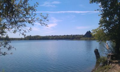
Lac de Maine, Artificial lake in Bouchemaine, France

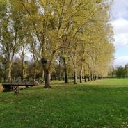
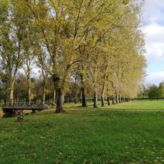
Lac de Maine is an artificial lake in Bouchemaine covering roughly 1.5 square kilometers with green spaces and walking paths throughout the area. The lake features a supervised swimming zone, leisure facilities, a play area, and picnic spots distributed around its perimeter.

The lake was created between 1960 and 1969 as a result of gravel quarrying operations that transformed former flood meadows known as Prairies d'Aloyaux. This transformation converted an industrial site into a recreational destination.

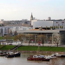
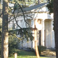
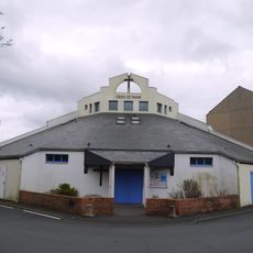
The pyramid-shaped building at the lake houses a nautical center and meeting spaces where locals and visitors gather for water activities and community events. It serves as a social hub that connects people to the water and outdoor recreation.

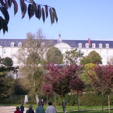
The site is easy to navigate with accessible pathways and facilities spread throughout the area, making it simple for visitors to find amenities. Restrooms, play equipment, and picnic tables are located at multiple points for convenience.

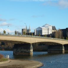
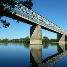
The lake connects to the Maine River, which itself is formed at the meeting point of three separate rivers: the Mayenne, Loir, and Sarthe. This convergence of waterways makes the area geographically significant to the surrounding region.

The community of curious travelers

AroundUs brings together thousands of curated places, local tips, and hidden gems, enriched daily by 60,000 contributors worldwide.

Start exploring
Location
Operator
Mairie d'Angers
GPS coordinates
47.45890,-0.58625
Latest update
December 6, 2025 17:43
The most beautiful places to photograph in Angers

Angers draws you in with the quiet beauty of a city where ancient stones seem to speak with the changing light. Once a royal seat and the heart of Anjou, this place brings together the solid strength of its medieval castle, the soaring lines of its Gothic cathedral, and gardens that feel almost...

Top family activities in Angers

Angers offers plenty of ways to spend time as a family, whether you want to explore gardens, visit historic sites, or try something playful and fun. You can walk through plant collections, ride bikes on an island, ice skate year-round, or get lost in a corn maze. The city has everything from castles...

« Lac de Maine - Artificial lake in Bouchemaine, France » is provided by Around Us (aroundus.com). Images and texts are derived from Wikimedia project under a Creative Commons license. You are allowed to copy, distribute, and modify copies of this page, under the conditions set by the license, as long as this note is clearly visible.

Discover hidden gems everywhere you go!

From secret cafés to breathtaking viewpoints, skip the crowded tourist spots and find places that match your style. Our app makes it easy with voice search, smart filtering, route optimization, and insider tips from travelers worldwide. Download now for the complete mobile experience.

Around Us App Screenshot

A unique approach to discovering new places

Le Figaro

All the places worth exploring

France Info

A tailor-made excursion in just a few clicks

20 Minutes

Around Us
Travel Guide & Maps
Download

Send to your phone

QR Code
1

Open the camera app on your mobile.

2

Point at the QR code with your camera. A notification will appear.

3

Tap the notification to open the link.