Enable Location

We need your location to show you interesting places around you

Discover nearby places

Find interesting locations and hidden gems around you

Precise directions

Get accurate directions and distances to places

Your location is never shared with other users. It's only used when you tap the location button.

Mont Tourvéon

Log in to your account

Start exploring — it's free

Trusted by 61,581 travelers worldwide

Continue with Google
Continue with Apple
or

We will send you a code to connect

By continuing, you accept our Terms and Conditions and our Privacy Policy

Check your inbox

We've sent a pincode in your inbox. Please enter the code below.

Mont Tourvéon

Mont Tourvéon, Mountain summit in Beaujolais region, Rhône, France

Description

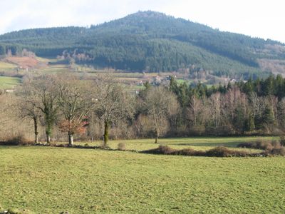
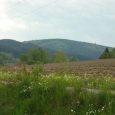
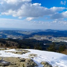
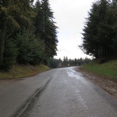
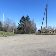
Mont Tourvéon is a mountain located across three municipalities: Chénelette, Saint-Didier-sur-Beaujeu, and Vernay in the Rhône department. The elevation reaches approximately 950 meters, and the slopes are partly forested, which limits views from the summit in some directions.

History

The summit once held a fortress called Château de Ganelon, which was completely demolished in the 9th century on the orders of Louis the Pious. This destruction left the site as the natural location it is today.

Culture

The area carries an old legend tied to Ganelon from the Song of Roland, who was reportedly rolled down the mountain in a barrel studded with spikes according to local lore. This tale shapes how people in the region understand and remember this place.

Practical

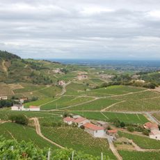
The summit offers views across several French regions including Brionnais, Charolais, Clunisois, and Mâconnais, though vegetation partially blocks sightlines in places. The mountain can be approached from different sides, giving visitors choice in their route up.

Did you know?

The mountain ranks as the fourth highest peak in the Beaujolais range and marks the origin point for two rivers: the Azergues and the Ardières. This role as a water divide makes it hydrologically important for the surrounding valleys.

Location
Elevation above the sea
949 m
Part of
Beaujolais
GPS coordinates
46.15886,4.50697
Latest update
December 14, 2025 20:04

AroundUs brings together thousands of curated places, local tips, and hidden gems, enriched daily by 60,000 contributors worldwide. Discover all places nearby (Rhône).

« Mont Tourvéon - Mountain summit in Beaujolais region, Rhône, France » is provided by Around Us (aroundus.com). Images and texts are derived from Wikimedia project under a Creative Commons license. You are allowed to copy, distribute, and modify copies of this page, under the conditions set by the license, as long as this note is clearly visible.

Discover hidden gems everywhere you go!

From secret cafés to breathtaking viewpoints, skip the crowded tourist spots and find places that match your style. Our app makes it easy with voice search, smart filtering, route optimization, and insider tips from travelers worldwide. Download now for the complete mobile experience.

Around Us App Screenshot

A unique approach to discovering new places

Le Figaro

All the places worth exploring

France Info

A tailor-made excursion in just a few clicks

20 Minutes

Around Us
Travel Guide & Maps
Download

Send to your phone

QR Code
1

Open the camera app on your mobile.

2

Point at the QR code with your camera. A notification will appear.

3

Tap the notification to open the link.