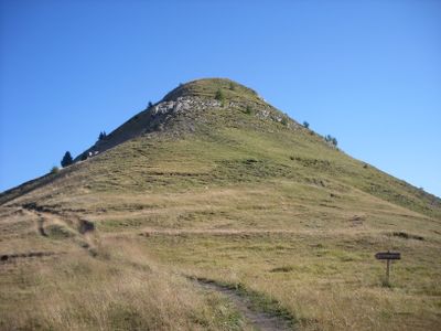
Le Palastre, Mountain peak in Hautes-Alpes, France.
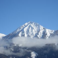
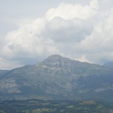
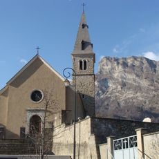
Le Palastre is a mountain peak in the Hautes-Alpes that rises to 2,278 meters (7,474 feet) within the Écrins massif, showing a clear profile against the French Alpine landscape. Its northern face displays striking parallel limestone layers that resemble natural staircases.
The peak was first documented in the 1800s when French military mapmakers surveyed and recorded the entire Hautes-Alpes region. This survey work was part of larger efforts to systematically map France's mountain areas.
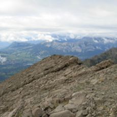
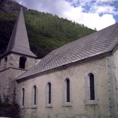
Shepherds have long used these mountain pastures for summer grazing, a practice that shapes how the landscape looks and changes with the seasons. This traditional activity keeps the slopes open and influences which plants grow here.
The hike to the summit takes about four hours from the nearest parking area and requires proper gear due to varying terrain. Good footwear and weather protection are important since conditions at the top can change quickly.
The northern face shows remarkable parallel limestone layers that look like stacked natural steps, visible from great distances across the valley. This geological feature stands out clearly when viewed from many parts of the surrounding valleys.
Location: Hautes-Alpes
Elevation above the sea: 2,278 m
GPS coordinates: 44.69287,6.20879
Latest update: December 14, 2025 20:27
Vieux Chaillol
5 km
Montorcier
2.6 km
Château de Saint-Léger-les-Mélèzes
5.4 km
Petite Autane
6.5 km
Pic Queyrel
5.3 km
Pic du Tourond
3 km
Chapelle de Chantaussel de Saint-Julien-en-Champsaur
6 km
Église de Chabottonnes
3.8 km
Église de Saint-Michel-de-Chaillol
3.4 km
Maison du Berger
5.1 km
Chapelle de la Nativité-de-la-Vierge de la Haute-Plaine
6.2 km
Église paroissiale de Saint-Jean-Saint-Nicolas
2.6 km
Église Saint-Léger de Saint-Léger-les-Mélèzes
5.4 km
Église paroissiale de Chabottes
4.9 km
Église de Champoléon
5.1 km
Chapelle Saint-Nicolas de Saint-Jean-Saint-Nicolas
2.8 km
Manoir de Prégentil
3 km
Chapelle de Pont-du-Fossé
3.1 km
Chapelle des Fermonds
4.6 km
Chapelle Saint-Claude de la Villette
4.1 km
Chapelle de Chaillolet
4.3 km
Église de Serre-Eyraud
5.5 km
Chapelle Saint-Jean-Baptiste des Gondouins
5.2 km
Chapelle Saint-Pierre-et-Saint-Paul des Estachys
3.8 km
Chapelle Saint-Grégoire-et-Saint-Pancrace des Ricous
4.5 km
Chapelle des Michauds
5.7 km
Chapelle Notre-Dame des Martins
4.9 km
Chapelle des Ranguis
3.2 kmVisited this place? Tap the stars to rate it and share your experience / photos with the community! Try now! You can cancel it anytime.
Discover hidden gems everywhere you go!
From secret cafés to breathtaking viewpoints, skip the crowded tourist spots and find places that match your style. Our app makes it easy with voice search, smart filtering, route optimization, and insider tips from travelers worldwide. Download now for the complete mobile experience.
A unique approach to discovering new places❞
— Le Figaro
All the places worth exploring❞
— France Info
A tailor-made excursion in just a few clicks❞
— 20 Minutes