Enable Location

We need your location to show you interesting places around you

Discover nearby places

Find interesting locations and hidden gems around you

Precise directions

Get accurate directions and distances to places

Your location is never shared with other users. It's only used when you tap the location button.

Pic Queyrel

Log in to your account

Start exploring — it's free

Trusted by 61,939 travelers worldwide

Continue with Google
Continue with Apple
or

We will send you a code to connect

By continuing, you accept our Terms and Conditions and our Privacy Policy

Check your inbox

We've sent a pincode in your inbox. Please enter the code below.

Pic Queyrel

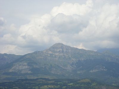
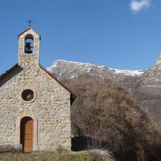
Pic Queyrel, Mountain summit in Hautes-Alpes, France

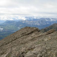
Pic Queyrel is a mountain summit in the Écrins massif rising to approximately 2435 meters with exposed rock faces and steep sections. The peak features challenging terrain and natural rock barriers that create climbing obstacles along the main routes.

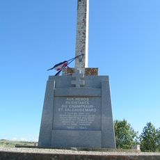
The mountain has long served as a boundary marker between neighboring mountain communities in the Hautes-Alpes region. Climbers have used this summit as a training objective for several decades.

The summit attracts climbers from the surrounding area who practice their skills and appreciate the mountain landscape. Visitors come to experience the environment firsthand and test themselves against Alpine terrain.

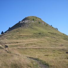
The hike from Chaillol ski station takes roughly two and a half hours with significant elevation gain and steep stretches. Start early in the day and monitor weather conditions carefully, as mountain weather can change rapidly at this elevation.

Along the hiking path stand two distinct rock barriers that create natural climbing obstacles. These formations present an unexpected challenge for those pushing toward the summit.

The community of curious travelers

AroundUs brings together thousands of curated places, local tips, and hidden gems, enriched daily by 60,000 contributors worldwide.

Start exploring
Location
Elevation above the sea
2,435 m
GPS coordinates
44.70715,6.14533
Latest update
December 14, 2025 20:26
« Pic Queyrel - Mountain summit in Hautes-Alpes, France » is provided by Around Us (aroundus.com). Images and texts are derived from Wikimedia project under a Creative Commons license. You are allowed to copy, distribute, and modify copies of this page, under the conditions set by the license, as long as this note is clearly visible.

Discover hidden gems everywhere you go!

From secret cafés to breathtaking viewpoints, skip the crowded tourist spots and find places that match your style. Our app makes it easy with voice search, smart filtering, route optimization, and insider tips from travelers worldwide. Download now for the complete mobile experience.

Around Us App Screenshot

A unique approach to discovering new places

Le Figaro

All the places worth exploring

France Info

A tailor-made excursion in just a few clicks

20 Minutes

Around Us
Travel Guide & Maps
Download

Send to your phone

QR Code
1

Open the camera app on your mobile.

2

Point at the QR code with your camera. A notification will appear.

3

Tap the notification to open the link.