Enable Location

We need your location to show you interesting places around you

Discover nearby places

Find interesting locations and hidden gems around you

Precise directions

Get accurate directions and distances to places

Your location is never shared with other users. It's only used when you tap the location button.

Menhirs d'Époigny

Log in to your account

Start exploring — it's free

Trusted by 61,575 travelers worldwide

Continue with Google
Continue with Apple
or

We will send you a code to connect

By continuing, you accept our Terms and Conditions and our Privacy Policy

Check your inbox

We've sent a pincode in your inbox. Please enter the code below.

Menhirs d'Époigny

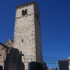
Menhirs d'Époigny, Neolithic menhir alignment in Couches, France

Description

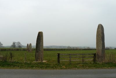
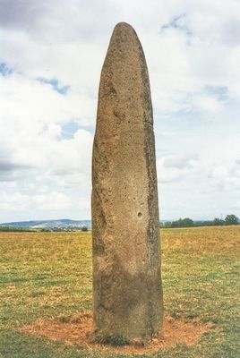
The Menhirs of Époigny consist of seven granite standing stones arranged in a V-shape on a plateau overlooking the Dheune Valley. The largest stone stands approximately 7 meters high and forms the focal point of this Neolithic arrangement.

History

These stones were erected roughly 5000 years ago during the Neolithic period to mark the boundary between the Saône and Loire river basins. The location sat near ancient pathways where people traveled and traded across the region.

Culture

The tallest stone displays engravings showing human figures, cup marks, and stylized axes on its southern face, revealing how Neolithic people expressed themselves through carving. These patterns offer insights into what mattered to the communities who gathered at this location.

Practical

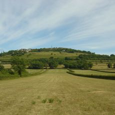
The site sits at 457 meters altitude on an open plateau and is accessible by turning toward Saint-Pierre-de-Varennes from the Autun road coming from Couches. The open location makes it easy to spot and reach on foot once you find the marked area.

Did you know?

The granite blocks originated from the Bouvier massif and were transported across roughly 8 kilometers to reach this plateau, a remarkable feat for Neolithic builders. Some stones weighed up to 30 tons, requiring coordination among many people to move and position them.

Location
GPS coordinates
46.87640,4.53448
Latest update
December 14, 2025 17:01

AroundUs brings together thousands of curated places, local tips, and hidden gems, enriched daily by 60,000 contributors worldwide. Discover all places nearby (Couches).

« Menhirs d'Époigny - Neolithic menhir alignment in Couches, France » is provided by Around Us (aroundus.com). Images and texts are derived from Wikimedia project under a Creative Commons license. You are allowed to copy, distribute, and modify copies of this page, under the conditions set by the license, as long as this note is clearly visible.

Discover hidden gems everywhere you go!

From secret cafés to breathtaking viewpoints, skip the crowded tourist spots and find places that match your style. Our app makes it easy with voice search, smart filtering, route optimization, and insider tips from travelers worldwide. Download now for the complete mobile experience.

Around Us App Screenshot

A unique approach to discovering new places

Le Figaro

All the places worth exploring

France Info

A tailor-made excursion in just a few clicks

20 Minutes

Around Us
Travel Guide & Maps
Download

Send to your phone

QR Code
1

Open the camera app on your mobile.

2

Point at the QR code with your camera. A notification will appear.

3

Tap the notification to open the link.