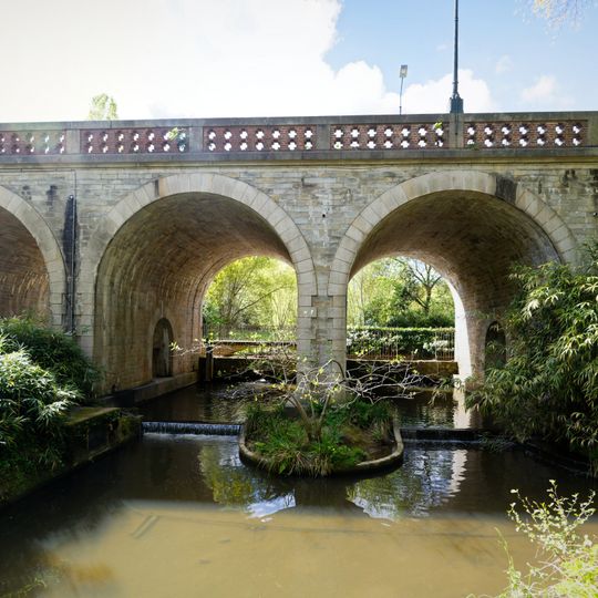
Pont Jules-César, Stone bridge in Nantes, France
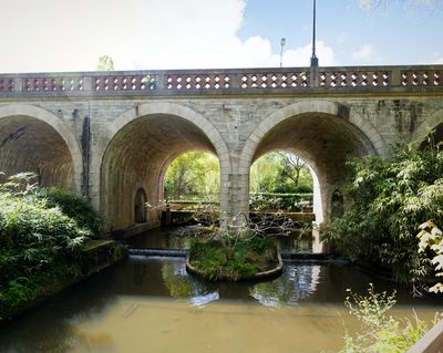
The Pont Jules-César spans the Chézine River, connecting the southern end of Boulevard des Anglais to the opposite side through multiple stone arches and brick parapets. The structure is sized to accommodate vehicles, bicycles, and pedestrians.
The structure was completed in 1879 during a period when Nantes was expanding. The bridge marked a boundary between the city and the neighboring area of Chantenay-sur-Loire.
The name comes from a legend that Caesar sailed up the Chézine to a spot called "Repos de Jules César" during his campaign against the Veneti of Armorica in 56 BC. Historians doubt the general ever came here; what is certain is that he ordered galleys built on the Loire for the legions that defeated the Veneti at the Battle of Morbihan.
You can walk or bike across, and there is also a lane for vehicle traffic. The best time to cross is during quieter hours when you can better observe the arches and the river below.
The name refers to a legend that Julius Caesar sailed up the Chézine to a spot called "Repos de Jules César" during his campaign against the Veneti of Armorica. Historians doubt he came to the region in 56 BC, but he certainly ordered galleys built on the Loire for the legions that defeated the Veneti at the Battle of Morbihan.
The community of curious travelers
AroundUs brings together thousands of curated places, local tips, and hidden gems, enriched daily by 93,635 contributors worldwide.