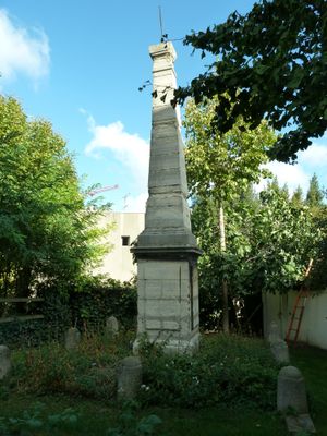
Pyramide de Cassini, Historic geodesic monument in Villejuif, France.
The Cassini Pyramid is a stone obelisk located on Avenue de Paris in Villejuif that was part of a measurement survey from the 18th century. The structure has a simple geometric shape and sits on a small piece of ground behind a black gate.
The monument was built in 1742 as a marker for measuring the Paris meridian line, which was later used to create detailed maps of France. This measurement line was one of the largest scientific projects of that era.
This monument marks a place where French surveyors worked to map the land in the 18th century through careful measurement and calculation. It represents the kind of scientific effort that was once necessary to understand the shape and size of France.
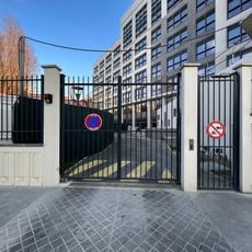
The monument sits behind a black gate along the street and is reached by climbing uneven stairs, so watch your footing carefully. It is next to a modern residential street but can be easily found from Avenue de Paris.
The monument is one of very few remaining measurement markers used in creating the Cassini map, one of the first accurate surveys of French territory. That map was groundbreaking for European cartography and revealed that previous knowledge of France's size was incorrect.
The community of curious travelers
AroundUs brings together thousands of curated places, local tips, and hidden gems, enriched daily by 60,000 contributors worldwide.