Truc de Fortunio, Mountain summit in Lozère, France
Truc de Fortunio is a mountain summit in Lozère that reaches 1552 meters and forms the highest point of the Margeride region. The peak rises from a plateau landscape with rocky slopes and open views across the surrounding highlands.
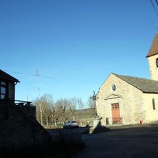
The summit has long served as a key navigation reference point on the Charpal Plateau for local communities. Its prominent position eventually made it suitable for installing communication infrastructure in recent decades.
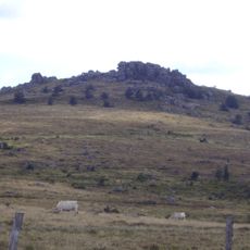
The exposed granite at the summit shows the raw geology of the Margeride massif. These stone formations shape how the landscape appears and feels to those who walk here.
The summit is reachable by taking the D59 road from Rieutort De Randon toward Estables, then following D3 until you see directional signs. Weather conditions matter here since elevation means wind and changing conditions can shift quickly.
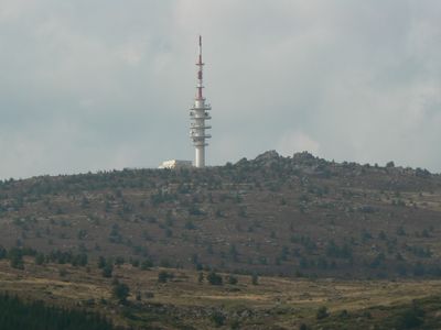
A telecommunications tower rises 105 meters from the summit and has broadcast television signals across the region since 2009. The tall structure is visible from a great distance and shows how modern technology found its place on this remote mountain peak.
Location: Lozère
Elevation above the sea: 1,552 m
GPS coordinates: 44.64248,3.53259
Latest update: December 11, 2025 18:10
Lac de Charpal
3.9 km
Lac de Ganivet
9.5 km
Signal de Randon
1.7 km
Pont Notre-Dame de Mende
13.7 km
Cénotaphe de Bertrand du Guesclin
11.4 km
Arboretum Curie
10.8 km
Col de la Tourette
11.9 km
Château de la Grange
10.6 km
Musée du Guesclin
11.3 km
Arboretum de Born
9.4 km
Église Notre-Dame de La Rouvière
11.8 km
Église Saint-Jean de Serverette
13.4 km
Croix de Serverette
13.3 km
Église Saint-Étienne de Châteauneuf-de-Randon
11.3 km
Église Saint-Julien de Rieutort-de-Randon
4.4 km
Église Saint-Christophe de Badaroux
12 km
Église Saint-Gall de Saint-Gal
9 km
Église de Laubert
10.7 km
Église Saint-Pierre-de-Vérone de Pelouse
10.6 km
Église Saints-Pierre-et-Paul de Servières
12.6 km
Église Saint-Hilaire d'Estables
4.6 km
Le Trianon
14 km
Statue of Bertrand du Guesclin
11.3 km
Église Saint-Privat des Laubies
9.4 km
Remparts de Mende
14 km
Chapelle Saint-Ferréol de Rieutort-de-Randon
1.7 km
Tour des Anglais
11.2 km
Maison forte de Bahours
13.3 kmVisited this place? Tap the stars to rate it and share your experience / photos with the community! Try now! You can cancel it anytime.
Discover hidden gems everywhere you go!
From secret cafés to breathtaking viewpoints, skip the crowded tourist spots and find places that match your style. Our app makes it easy with voice search, smart filtering, route optimization, and insider tips from travelers worldwide. Download now for the complete mobile experience.
A unique approach to discovering new places❞
— Le Figaro
All the places worth exploring❞
— France Info
A tailor-made excursion in just a few clicks❞
— 20 Minutes