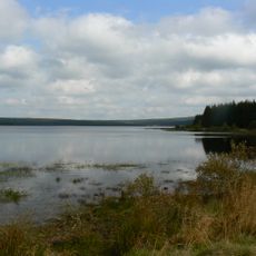
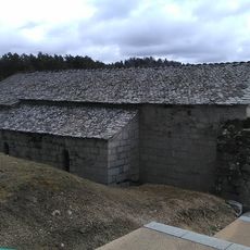
Lac de Ganivet, reservoir in France
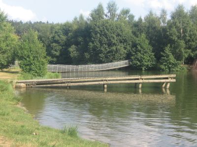
Lac de Ganivet is a human-made reservoir nestled in the mountains of Lozère at roughly 1,000 meters (3,280 feet) elevation in the southern Margeride region. The water is fed by the Colagne River and features a small island with trees in its center, accessible by a wooden footbridge.
The reservoir was built to store water for the region and sits downstream from another lake called Charpal in the Colagne River system. Its creation reflects modern water management efforts in the Lozère mountain area.
The lake serves as a gathering place where local families and visitors come to unwind and reconnect with nature in the quiet mountain setting. People use the surrounding paths and waterside areas in their own way, from picnicking to fishing, making it a spot where the rhythm of outdoor life unfolds naturally.
The lake is easy to reach and works well for both day trips and longer stays near the village of Ribennes. Visitors will find a campground, small cottages for accommodation, and designated picnic areas with tables by the water.
A hanging footbridge connects the shoreline to a small island in the middle of the lake, a feature many visitors find memorable and enjoy exploring. The island offers benches and a different perspective of the water and surrounding landscape.
The community of curious travelers
AroundUs brings together thousands of curated places, local tips, and hidden gems, enriched daily by 60,000 contributors worldwide.