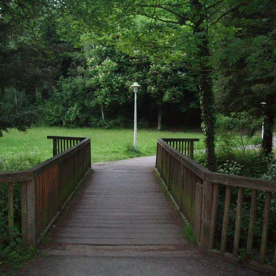
Vallée du Cens, Natural valley trail in Nantes, France.
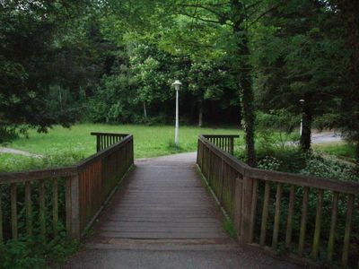
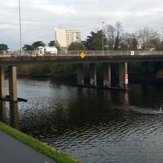
Vallée du Cens is the last 2,500 metres of the Cens river, which rises at Vigneux-de-Bretagne and flows into the Erdre in Nantes. The valley begins at the Pont du Cens on the route de Rennes and ends at the confluence near the Petit Port. A wooden footbridge with moss-covered railings on one side links the Barberie district, via avenue de Tahiti, to the Côte d'Or, via avenue d'Armor.
The valley's name comes from the Cens, a river rising in Vigneux-de-Bretagne and meeting the Erdre in Nantes; the valley covers its last 2,500 metres. In the 1970s Nantes created a riverside promenade here, a first for the city, linking the Pont du Cens area near the route de Rennes to the confluence past Petit Port.
The river marks the administrative boundary between three Nantes neighbourhoods: Nantes Nord on the left bank, and Breil - Barberie and Hauts-Pavés - Saint-Félix on the right bank. The wooden footbridge links the Barberie district, reached via avenue de Tahiti, to the Côte d'Or district, reached via avenue d'Armor.
The valley walk begins in Nantes at the Pont du Cens area by the route de Rennes and follows the last 2,500 metres of the Cens to its confluence with the Erdre, just past Petit Port. The river forms the boundary between Nantes Nord on the left bank and Breil - Barberie then Hauts-Pavés - Saint-Félix on the right. Small bridges link the neighbourhoods; the wooden one joins Barberie (avenue de Tahiti) to Côte d'Or (avenue d'Armor).
The wooden footbridge over the Cens links Avenue de Tahiti in the Barberie district to Avenue d'Armor in the Côte d'Or district, one of many small bridges built so the 1970s riverside promenade could connect neighbourhoods. Its right-hand railing is coated in green moss and algae, while the left stays bare weathered wood.
The community of curious travelers
AroundUs brings together thousands of curated places, local tips, and hidden gems, enriched daily by 94,141 contributors worldwide.