Chest opened
+${chestReward.xp} XP
Explorer
NOUVEAU ×${chestReward.collectible.quantity}
tapez pour fermer

See the monuments around you in AR Open chests in the app

Around Us is built for your phone — point your camera at the streets and discover the monuments and places around you in augmented reality. Around Us is built for your phone — chests unlock when you walk, explore and capture nearby places.

•

Enable Location

We need your location to show you interesting places around you

Discover nearby places

Find interesting locations and hidden gems around you

Precise directions

Get accurate directions and distances to places

Your location is never shared with other users. It's only used when you tap the location button.

Sudelkopf

Log in to your account

Start exploring — it's free

Trusted by 93,784 travelers worldwide

Continue with Google
Continue with Apple
or

We will send you a code to connect

By continuing, you accept our Terms and Conditions and our Privacy Policy

Check your inbox

We've sent a pincode in your inbox. Please enter the code below.

Sudelkopf

Sudelkopf, Mountain summit in Haut-Rhin, France

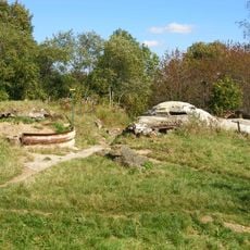
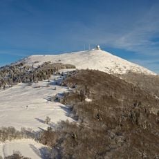
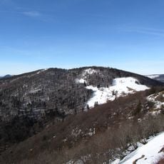
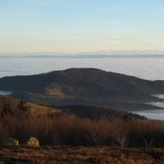
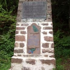
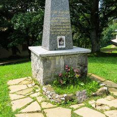
Sudelkopf is a summit in the Vosges rising to 1,012 metres near the Route des Crêtes between the Grand Ballon and the Col Amic. Its slopes are covered in dense coniferous forest, with pale bare patches and exposed rock on the lower left. A concrete monument inscribed "HESSEN-NIERT" and "ERBAUT LANDWEHR JNF.RGT.13/87 1916" stands in the woods.

During World War I, this peak served as a strategic observation post where military forces monitored movements across the Vosges valleys. The high position gave armies clear sightlines to control surrounding territory during intense fighting in the region.

The summit lies near the Route des Crêtes between the Grand Ballon and the Col Amic. The stone monument at the pass, inscribed "HESSEN-NIERT" and "ERBAUT LANDWEHR JNF.RGT.13/87 1916", recalls the German Landwehr infantry units stationed here during the First World War.

Wear sturdy hiking boots and bring layers, as weather changes quickly at elevation and conditions can become slippery after rain. The main trails are well-marked, making navigation straightforward, but early morning starts help you avoid afternoon cloud cover and crowds.

This peak serves as a junction point where the GR53 and GR5 long-distance trails intersect, allowing hikers to continue for days through the range. Few visitors realize they can string together multiple summits without returning to a road or trailhead by using these marked corridors.

The community of curious travelers

AroundUs brings together thousands of curated places, local tips, and hidden gems, enriched daily by 93,784 contributors worldwide.

Start exploring
Location
Elevation above the sea
1,012 m
GPS coordinates
47.88581,7.13087
Latest update
October 28, 2026 18:27
Reviews
Share your experience

No review yet

Discussions
Start a discussion...

No discussion yet

« Sudelkopf - Mountain summit in Haut-Rhin, France » is provided by Around Us (aroundus.com). Images and texts are derived from Wikimedia project under a Creative Commons license. You are allowed to copy, distribute, and modify copies of this page, under the conditions set by the license, as long as this note is clearly visible.

Discover hidden gems everywhere you go!

From secret cafés to breathtaking viewpoints, skip the crowded tourist spots and find places that match your style. Our app makes it easy with voice search, smart filtering, route optimization, and insider tips from travelers worldwide. Download now for the complete mobile experience.

Around Us App Screenshot
❝

A unique approach to discovering new places❞

— Le Figaro

❝

All the places worth exploring❞

— France Info

❝

A tailor-made excursion in just a few clicks❞

— 20 Minutes

Around Us
Travel Guide & Maps
Download

Send to your phone

QR Code
1

Open the camera app on your mobile.

2

Point at the QR code with your camera. A notification will appear.

3

Tap the notification to open the link.