Signal de la Sauvette, Mountain summit at 780 meters in Var, France
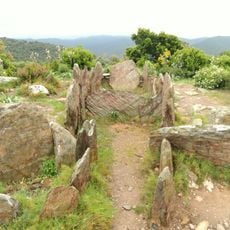
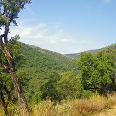
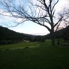
Signal de la Sauvette is the highest peak of the Maures range at approximately 780 meters and dominates the southern Var landscape. Its slopes are composed of metamorphic rock formations and covered with low-growing shrubs adapted to Mediterranean conditions.
The mountain's structure formed during the Paleozoic era through ancient geological processes that shaped southeastern France. This rock composition reflects the long history of mountain building and folding in the region.
The peak serves as a meeting point for hikers who seek views of the surrounding landscape and solitude in nature. The ridge attracts those interested in experiencing the wild character of the Maures range.
The hike typically begins from Collobrières village and requires sturdy footwear and a good water supply. Pay attention to weather conditions since the upper slopes are exposed and conditions can change quickly.
On clear days, you can see both the Mediterranean Sea and the inland mountain ridges from this vantage point. This dual perspective makes it a rare spot for viewing landscapes in opposite directions.
Location: Var
Elevation above the sea: 780 m
Made from material: metamorphic rock
GPS coordinates: 43.27584,6.33672
Latest update: December 14, 2025 15:01
Chartreuse de la Verne
6.9 km
Villa La Reine Jeanne
20.6 km
Chapelle Notre-Dame des Anges
3.5 km
Château Aurélien de Fréjus
8.7 km
Le Village des Tortues
10.6 km
Village des tortues
10.6 km
Aoubré
13.4 km
Église Saint-Trophyme de Bormes-les-Mimosas
13.8 km
Gaoutabry dolmen
14 km
Menhirs de la Ferme Lambert
6.6 km
Chapelle Saint-François-de-Paule de Bormes-les-Mimosas
13.9 km
Arboretum de Gratteloup
10.8 kmEglise Saint-Michel du Vieux-Cannet
14 km
Chapelle Sainte-Magdeleine de La Môle
12.3 km
Église Notre-Dame-de-l'Assomption de Flassans-sur-Issole
14 km
Église Saint-Pons
4.8 km
Chapelle Saint-Roch de Flassans-sur-Issole
13.9 km
Église Notre-Dame de Nazareth du Luc
13.2 km
Église Notre-Dame-de-l'Assomption de Carnoules
12.8 km
Église Notre-Dame-du-Mont-Carmel du Luc
13.4 km
La Croix des Maures
11.5 km
Église Saint-Clément de La Garde-Freinet
11.6 km
Pignans collegiate church
9.3 km
Église Sainte-Marie-Madeleine de La Môle
12.8 km
Golf de Valcros
11.8 km
Château des seigneurs de Fos
13.8 km
Arboretum Du Treps
4.5 km
Église Notre-Dame de-l'Immaculée-Conception de Gonfaron
6.2 kmVisited this place? Tap the stars to rate it and share your experience / photos with the community! Try now! You can cancel it anytime.
Discover hidden gems everywhere you go!
From secret cafés to breathtaking viewpoints, skip the crowded tourist spots and find places that match your style. Our app makes it easy with voice search, smart filtering, route optimization, and insider tips from travelers worldwide. Download now for the complete mobile experience.
A unique approach to discovering new places❞
— Le Figaro
All the places worth exploring❞
— France Info
A tailor-made excursion in just a few clicks❞
— 20 Minutes