Enable Location

We need your location to show you interesting places around you

Discover nearby places

Find interesting locations and hidden gems around you

Precise directions

Get accurate directions and distances to places

Your location is never shared with other users. It's only used when you tap the location button.

Gaoutabry dolmen

Log in to your account

Start exploring — it's free

Trusted by 61,992 travelers worldwide

Continue with Google
Continue with Apple
or

We will send you a code to connect

By continuing, you accept our Terms and Conditions and our Privacy Policy

Check your inbox

We've sent a pincode in your inbox. Please enter the code below.

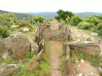
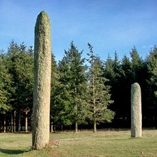
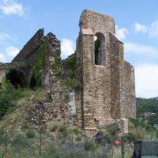
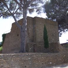
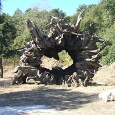
Gaoutabry dolmen, Neolithic tomb in La Londe-les-Maures, France

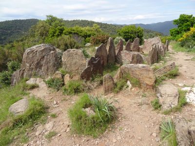
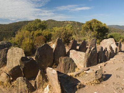
The Gaoutabry dolmen stands as the largest monument of its kind in Var department, measuring approximately ten meters long and built from local schist slabs arranged to form a burial chamber and antechamber.

Discovered in 1876 by Baron Gustave Charles Ferdinand de Bonstetten, this monument was initially thought to be three separate structures before being confirmed as a single construction dating from 2800 to 2000 BC.

Archaeological excavations in 1975 uncovered remains of at least 34 individuals along with pottery fragments, flint arrowheads, crystal beads, and daggers, now preserved at the Archaeological Museum of Saint-Raphaël.

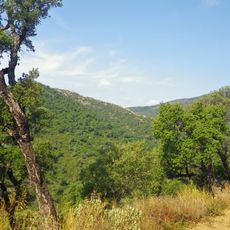
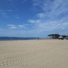
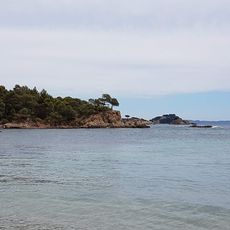
Located at 198 meters altitude in the Massif des Maures, the site is accessible via a marked blue trail from Notre Dame des Maures parking area, closed between June 21 and September 20 due to fire prevention measures.

The vertical stone slabs separating the chamber from the antechamber display notches suggesting they may have supported a wooden or stone roof, a construction technique rarely documented in Provençal dolmens.

The community of curious travelers

AroundUs brings together thousands of curated places, local tips, and hidden gems, enriched daily by 60,000 contributors worldwide.

Start exploring
Address
83250 La Londe-les-Maures, France
GPS coordinates
43.17180,6.23880
Latest update
November 23, 2025 21:00
Hiking along the French Riviera: Coastal paths between Nice and Monaco, from Cap d'Ail to the Gorges du Verdon

Between Nice and Monaco, coastal trails provide the opportunity to explore the Mediterranean coastline through various routes. The Cap d'Ail Coastal Path, Nietzsche's Path in Èze with 400 meters of elevation gain, and the Mont Boron Park in Nice with its 11 kilometers of marked trails allow...

« Gaoutabry dolmen - Neolithic tomb in La Londe-les-Maures, France » is provided by Around Us (aroundus.com). Images and texts are derived from Wikimedia project under a Creative Commons license. You are allowed to copy, distribute, and modify copies of this page, under the conditions set by the license, as long as this note is clearly visible.

Discover hidden gems everywhere you go!

From secret cafés to breathtaking viewpoints, skip the crowded tourist spots and find places that match your style. Our app makes it easy with voice search, smart filtering, route optimization, and insider tips from travelers worldwide. Download now for the complete mobile experience.

Around Us App Screenshot

A unique approach to discovering new places

Le Figaro

All the places worth exploring

France Info

A tailor-made excursion in just a few clicks

20 Minutes

Around Us
Travel Guide & Maps
Download

Send to your phone

QR Code
1

Open the camera app on your mobile.

2

Point at the QR code with your camera. A notification will appear.

3

Tap the notification to open the link.