Alignement du Pilier, Stone row in Le Gâvre, France
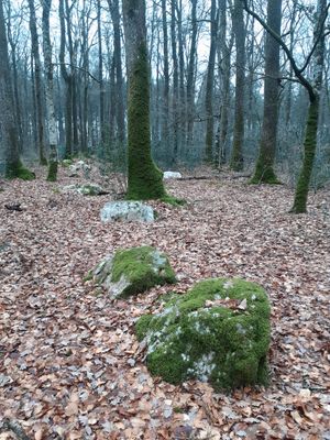
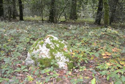
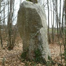
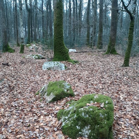
The Alignement du Pilier is a stone row in the northern part of the Gâvre forest, in Loire-Atlantique. About 120 blocks of milky quartz and quartzite, with some green-grey schist veined with white quartz, lie along a northwest-southeast axis: a single 400 m row to the west and two parallel 500 m rows to the east, plus three perpendicular secondary rows of nine blocks. Blocks weigh up to 600 kg and sit in foundation pits; moss covers much of the pale grey stone.
Reported in 1976 by local resident Mme Coué to historian Jack Hurtaud, the row was not accepted as human-made until visits in 2006-2007; survey and clearing followed in 2008. Optically stimulated luminescence dating of sediment in a foundation pit, checked against radiocarbon dates from a nearby pit, places the stones in the Early Bronze Age, around 2040-1680 BC.
The name comes from the nearby Pilier crossroads, where the allée du Pilier meets the allée du Breuil de la Herse. Local resident Mme Coué reported the line of stones to historian Jack Hurtaud in 1976, and his one-page article appeared in 1978 in the bulletin of the Société polymathique du Morbihan. The Musée Benoît in Le Gâvre occasionally leads guided walks to the stones.
The stone row is located in the northern section of the forest and is accessible via forest paths, especially from Breuil de la Herse toward Pilier crossing. Walking on unpaved forest trails requires appropriate footwear and attention to ground conditions.
The three secondary rows of nine blocks lie perpendicular to the two parallel eastern rows, near the Pilier forest crossroads where the allée des Malnoës meets the allée du Pilier. The blocks are mostly milky quartz and quartzite, some green-grey schist veined with white quartz, each weighing up to 600 kg.
The community of curious travelers
AroundUs brings together thousands of curated places, local tips, and hidden gems, enriched daily by 92,996 contributors worldwide.