Enable Location

We need your location to show you interesting places around you

Discover nearby places

Find interesting locations and hidden gems around you

Precise directions

Get accurate directions and distances to places

Your location is never shared with other users. It's only used when you tap the location button.

Aerial tramway of the Plateau de Bure

Log in to your account

Start exploring — it's free

Trusted by 65,306 travelers worldwide

Continue with Google
Continue with Apple
or

We will send you a code to connect

By continuing, you accept our Terms and Conditions and our Privacy Policy

Check your inbox

We've sent a pincode in your inbox. Please enter the code below.

Aerial tramway of the Plateau de Bure
Discussion Reviews 1 Photos
6.4k Popularity

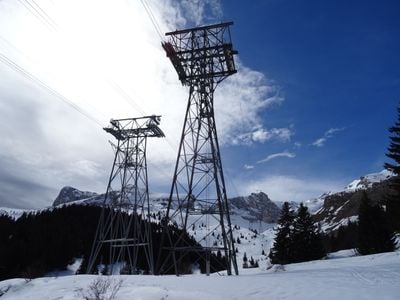
Aerial tramway of the Plateau de Bure, Cable transport system in French Alps, France.

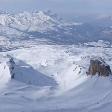
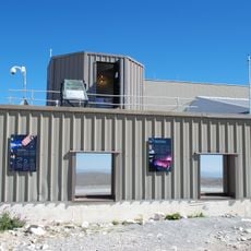
The aerial tramway of the Plateau de Bure is a cable transport system in the French Alps that links a valley to the Plateau de Bure, sitting at around 2550 meters above sea level. The system runs on a line of pylons and carries both passengers and cargo to the observatory located on the plateau.

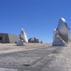
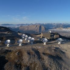
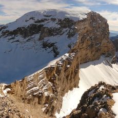
The tramway was built to support the installation and ongoing operation of a radio astronomy facility on the plateau. Before it existed, reaching the site with heavy equipment was extremely difficult due to the terrain.

The tramway serves the researchers of the observatory and is not a tourist transport. Those who ride it are generally part of a scientific team, which gives the plateau the feel of a remote working station rather than a public destination.

Access to the tramway is not open to the general public and requires prior authorization, as the system operates mainly for scientific purposes. Weather on the plateau can change rapidly, so warm and windproof clothing is a practical necessity.

Some of the antenna components used at the observatory were brought up piece by piece in the tramway's cabins, as no other route could handle equipment of that size and weight. The cabins were specifically designed to accommodate oversized scientific loads.

The community of curious travelers

AroundUs brings together thousands of curated places, local tips, and hidden gems, enriched daily by 60,000 contributors worldwide.

Start exploring
GPS coordinates
44.66111,5.93861
Latest update
March 3, 2026 22:40
Reviews
Share your experience

No review yet

Discussions
Start a discussion...

No discussion yet

« Aerial tramway of the Plateau de Bure - Cable transport system in French Alps, France » is provided by Around Us (aroundus.com). Images and texts are derived from Wikimedia project under a Creative Commons license. You are allowed to copy, distribute, and modify copies of this page, under the conditions set by the license, as long as this note is clearly visible.

Discover hidden gems everywhere you go!

From secret cafés to breathtaking viewpoints, skip the crowded tourist spots and find places that match your style. Our app makes it easy with voice search, smart filtering, route optimization, and insider tips from travelers worldwide. Download now for the complete mobile experience.

Around Us App Screenshot

A unique approach to discovering new places

Le Figaro

All the places worth exploring

France Info

A tailor-made excursion in just a few clicks

20 Minutes

Around Us
Travel Guide & Maps
Download

Send to your phone

QR Code
1

Open the camera app on your mobile.

2

Point at the QR code with your camera. A notification will appear.

3

Tap the notification to open the link.