Rocher Rond, Mountain summit in Drôme, France
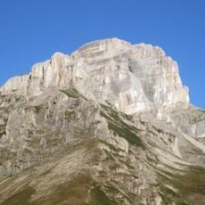
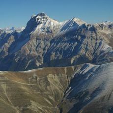
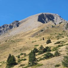
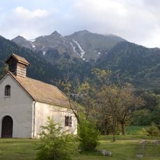
Rocher Rond is a limestone summit in the Dévoluy massif of the French Alps, reaching 2453 metres. It is the highest point of the Drôme department and of the Vercors Regional Natural Park, though it lies outside the Vercors massif itself. Its western side is almost entirely exposed rock and cliffs above the Lac du Lauzon, while the broad upper mass carries snow over dark grey rock in horizontal bands.
The summit formed during the Santonian geological period through ancient processes that shaped the Alps. The surrounding mountains display distinct rock layers from earlier Barremian and Neocomian times.
The name Rocher Rond means "round rock", after the broad rounded summit mass seen from below. The summit also bears the name tête du Fleyrard. It marks the highest point of the Drôme department and of the Vercors Regional Natural Park, though it lies in the Dévoluy massif, not the Vercors massif itself.
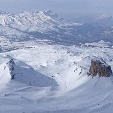
Heavy snow covers the eastern slope from December through March, making winter sports possible during these months. Visitors should prepare for alpine conditions and bring appropriate gear for mountain weather.
Rocher Rond is the highest point of the Drôme department and of the Vercors Regional Natural Park, yet it lies in the Dévoluy massif, not in the Vercors massif itself. It is the 14th highest French department highpoint, with an isolation of 8.77 km.
The community of curious travelers
AroundUs brings together thousands of curated places, local tips, and hidden gems, enriched daily by 94,660 contributors worldwide.