Enable Location

We need your location to show you interesting places around you

Discover nearby places

Find interesting locations and hidden gems around you

Precise directions

Get accurate directions and distances to places

Your location is never shared with other users. It's only used when you tap the location button.

Croix de Cibouit

Log in to your account

Start exploring — it's free

Trusted by 64,086 travelers worldwide

Continue with Google
Continue with Apple
or

We will send you a code to connect

By continuing, you accept our Terms and Conditions and our Privacy Policy

Check your inbox

We've sent a pincode in your inbox. Please enter the code below.

Croix de Cibouit
Discussion Reviews 1 Photos
30+ Popularity

Croix de Cibouit, Mountain peak in Massif des Écrins, France.

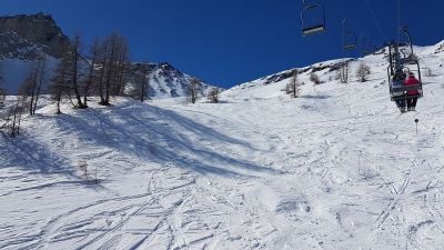
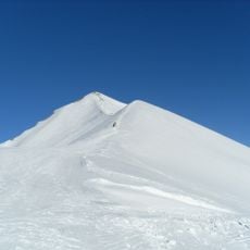
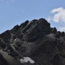
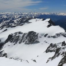
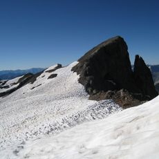
Croix de Cibouit is a rocky summit in the French Alps at 2490 meters elevation, featuring steep slopes with limestone formations visible on its upper reaches. The mountain is accessible via the GR 54 trail system, which begins from the Monetier-les-Bains parking area and rises steadily through alpine terrain.

During medieval times, shepherds used this peak as a landmark to navigate their seasonal migrations across the mountain passes of the region. It served as a key reference point for guiding livestock movements through the high alpine passages.

Local mountaineering clubs organize annual gatherings at the summit to maintain climbing traditions and document changes in the alpine environment.

The area is accessible year-round, though the best window for hiking is from June through September when snow cover is minimal and the trail remains safe. Visitors should bring weather-resistant gear and sturdy footwear as mountain conditions can change quickly.

The summit contains geological markers that researchers use to measure gradual elevation changes occurring across the Alpine mountain range. These scientific reference points contribute to understanding long-term shifts in the alpine landscape.

The community of curious travelers

AroundUs brings together thousands of curated places, local tips, and hidden gems, enriched daily by 60,000 contributors worldwide.

Start exploring
Elevation above the sea
2,490 m
Address
Crête de Cibouit, 05220 Le Monêtier-les-Bains, France
GPS coordinates
44.94604,6.48665
Latest update
February 27, 2026 14:45
Reviews
Share your experience

No review yet

Discussions
Start a discussion...

No discussion yet

« Croix de Cibouit - Mountain peak in Massif des Écrins, France » is provided by Around Us (aroundus.com). Images and texts are derived from Wikimedia project under a Creative Commons license. You are allowed to copy, distribute, and modify copies of this page, under the conditions set by the license, as long as this note is clearly visible.

Discover hidden gems everywhere you go!

From secret cafés to breathtaking viewpoints, skip the crowded tourist spots and find places that match your style. Our app makes it easy with voice search, smart filtering, route optimization, and insider tips from travelers worldwide. Download now for the complete mobile experience.

Around Us App Screenshot

A unique approach to discovering new places

Le Figaro

All the places worth exploring

France Info

A tailor-made excursion in just a few clicks

20 Minutes

Around Us
Travel Guide & Maps
Download

Send to your phone

QR Code
1

Open the camera app on your mobile.

2

Point at the QR code with your camera. A notification will appear.

3

Tap the notification to open the link.