Enable Location

We need your location to show you interesting places around you

Discover nearby places

Find interesting locations and hidden gems around you

Precise directions

Get accurate directions and distances to places

Your location is never shared with other users. It's only used when you tap the location button.

Sentier des capitelles bernissoises

Log in to your account

Start exploring — it's free

Trusted by 61,509 travelers worldwide

Continue with Google
Continue with Apple
or

We will send you a code to connect

By continuing, you accept our Terms and Conditions and our Privacy Policy

Check your inbox

We've sent a pincode in your inbox. Please enter the code below.

Sentier des capitelles bernissoises

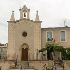
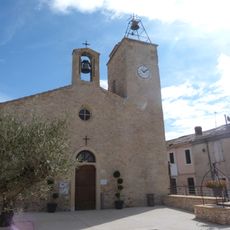
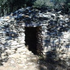
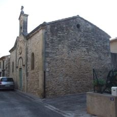
Sentier des capitelles bernissoises, Historic stone huts trail in Bernis, France.

Description

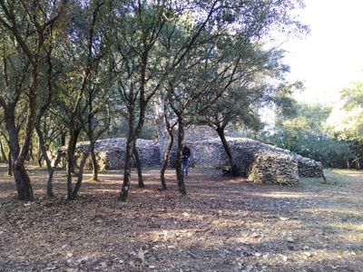
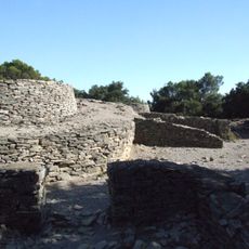
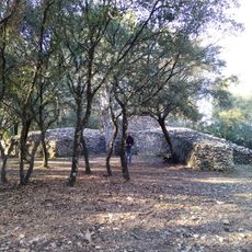
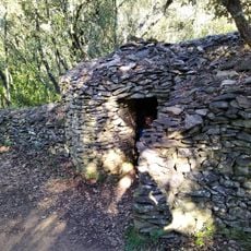
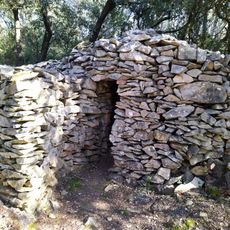
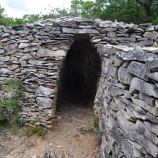
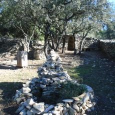
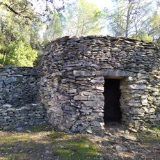
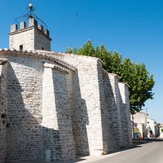
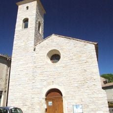
The Sentier des Capitelles Bernissoises is a hiking trail through the Mediterranean landscape of Bernis featuring numerous traditional limestone shelters built without mortar. The path winds through olive groves and abandoned vineyards, connecting various preserved structures throughout the area.

History

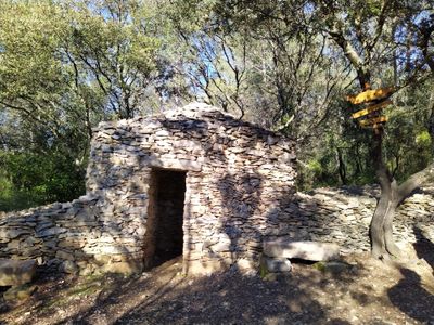
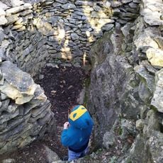
The stone shelters were built during periods when workers labored in olive groves and vineyards and needed quick protection from harsh weather. By the mid-20th century, volunteers began restoring these forgotten structures to preserve their memory.

Culture

The shelters along the path show how farm workers once sought protection from sun and rain while tending their land. These stone structures belong to the daily life and hard work of the region's agricultural past.

Practical

The trail is well marked with information boards at several points explaining details about each structure. It is wise to wear sturdy shoes and bring water, as the path remains mostly exposed to the sun throughout the walk.

Did you know?

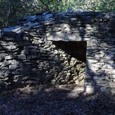
Some of the shelters along the trail have been given names such as the Grand Bois shelter and the Picholine shelter, named after local olive varieties. These names reveal how closely linked the work of people was to agriculture in the area.

Location
Location
GPS coordinates
43.78086,4.25934
Latest update
December 6, 2025 17:48

AroundUs brings together thousands of curated places, local tips, and hidden gems, enriched daily by 60,000 contributors worldwide. Discover all places nearby (Bernis).

Places to photograph in Nîmes: Roman monuments, modern architecture, and historic gardens

Nîmes brings together two thousand years of architecture in one view. As you walk, you pass from the Roman amphitheater of the first century to the glass façade of the Carré d'Art, built in the 1990s. The Maison Carrée, an ancient temple with Corinthian columns, faces this contemporary art museum in...

« Sentier des capitelles bernissoises - Historic stone huts trail in Bernis, France » is provided by Around Us (aroundus.com). Images and texts are derived from Wikimedia project under a Creative Commons license. You are allowed to copy, distribute, and modify copies of this page, under the conditions set by the license, as long as this note is clearly visible.

Discover hidden gems everywhere you go!

From secret cafés to breathtaking viewpoints, skip the crowded tourist spots and find places that match your style. Our app makes it easy with voice search, smart filtering, route optimization, and insider tips from travelers worldwide. Download now for the complete mobile experience.

Around Us App Screenshot

A unique approach to discovering new places

Le Figaro

All the places worth exploring

France Info

A tailor-made excursion in just a few clicks

20 Minutes

Around Us
Travel Guide & Maps
Download

Send to your phone

QR Code
1

Open the camera app on your mobile.

2

Point at the QR code with your camera. A notification will appear.

3

Tap the notification to open the link.