Enable Location

We need your location to show you interesting places around you

Discover nearby places

Find interesting locations and hidden gems around you

Precise directions

Get accurate directions and distances to places

Your location is never shared with other users. It's only used when you tap the location button.

Mont Guillaume

Log in to your account

Start exploring — it's free

Trusted by 61,938 travelers worldwide

Continue with Google
Continue with Apple
or

We will send you a code to connect

By continuing, you accept our Terms and Conditions and our Privacy Policy

Check your inbox

We've sent a pincode in your inbox. Please enter the code below.

Mont Guillaume

Mont Guillaume, Alpine summit in Embrun, France

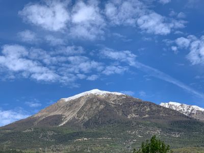
Mont Guillaume is an Alpine summit near Embrun that rises to 2542 meters and offers wide views over Lake Serre-Ponçon and surrounding mountain ranges. The landscape features larch forests and alpine vegetation across the slopes and ridges.

The first ski ascent of the summit occurred in 1897 when an officer of the Alpine Hunters completed the climb in about five and a half hours. This early expedition marks an important moment in the mountaineering history of the French Alps.

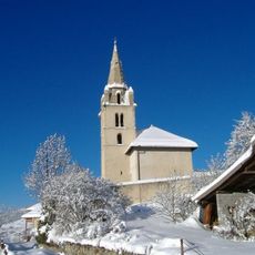
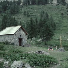
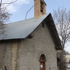
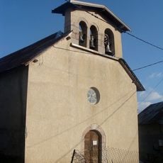
A chapel at the Séyères pass serves as a gathering spot where locals and visitors meet during their mountain journeys. The site holds meaning for the community as a place of reflection in the high peaks.

The hiking trail starts from a forest parking area near the hamlet of Caleyère in Embrun, at about 1587 meters elevation. Starting early in the day and bringing appropriate gear for altitude and changing weather conditions is advisable.

The hiking paths pass through larch forests where rare alpine plants such as edelweiss grow naturally. Génépi, an herb from this region, has been used by locals for making a distinctive mountain liqueur.

The community of curious travelers

AroundUs brings together thousands of curated places, local tips, and hidden gems, enriched daily by 60,000 contributors worldwide.

Start exploring
Location
Elevation above the sea
2,542 m
GPS coordinates
44.58542,6.43709
Latest update
December 14, 2025 16:40
« Mont Guillaume - Alpine summit in Embrun, France » is provided by Around Us (aroundus.com). Images and texts are derived from Wikimedia project under a Creative Commons license. You are allowed to copy, distribute, and modify copies of this page, under the conditions set by the license, as long as this note is clearly visible.

Discover hidden gems everywhere you go!

From secret cafés to breathtaking viewpoints, skip the crowded tourist spots and find places that match your style. Our app makes it easy with voice search, smart filtering, route optimization, and insider tips from travelers worldwide. Download now for the complete mobile experience.

Around Us App Screenshot

A unique approach to discovering new places

Le Figaro

All the places worth exploring

France Info

A tailor-made excursion in just a few clicks

20 Minutes

Around Us
Travel Guide & Maps
Download

Send to your phone

QR Code
1

Open the camera app on your mobile.

2

Point at the QR code with your camera. A notification will appear.

3

Tap the notification to open the link.