Chest opened
+${chestReward.xp} XP
Explorer
NOUVEAU ×${chestReward.collectible.quantity}
tapez pour fermer

See the monuments around you in AR Open chests in the app

Around Us is built for your phone — point your camera at the streets and discover the monuments and places around you in augmented reality. Around Us is built for your phone — chests unlock when you walk, explore and capture nearby places.

•

Enable Location

We need your location to show you interesting places around you

Discover nearby places

Find interesting locations and hidden gems around you

Precise directions

Get accurate directions and distances to places

Your location is never shared with other users. It's only used when you tap the location button.

Vrgorsko polje

Log in to your account

Start exploring — it's free

Trusted by 94,550 travelers worldwide

Continue with Google
Continue with Apple
or

We will send you a code to connect

By continuing, you accept our Terms and Conditions and our Privacy Policy

Check your inbox

We've sent a pincode in your inbox. Please enter the code below.

Vrgorsko polje

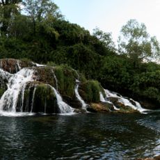
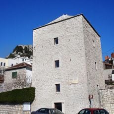
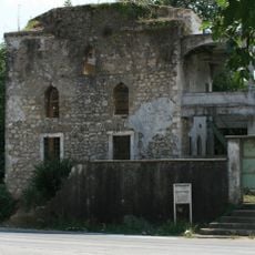
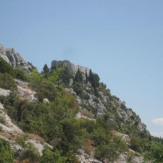
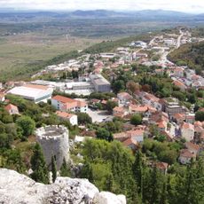
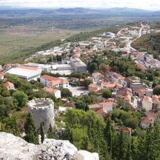
Vrgorsko polje, Karst field in Dalmatia, Croatia

Vrgorsko polje is a karst field in Dalmatia that spreads across the landscape between Vrgorac and Ploče. The Matica River flows through this plain, fed by several natural springs and eventually disappearing into sinkholes at the field's southeastern end.

The field's local name, Jezero, means lake, because winter flooding regularly covered the lower ground before drainage works. By October 1938 a 2,130-metre drainage tunnel had been dug to carry water to the Baćina lakes, from where a 160-metre tunnel leads it to the sea. Post-war works included cutting the Prigon rock saddle in 1945–1946, and drainage works between 1972 and 1977 increased outflow, though excess water still is not fully solved.

Regional farmers maintain traditional agricultural practices by cultivating strawberries, cereals, vines, tobacco, and vegetables across 28.4 square kilometers of fertile land.

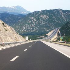
The Zagreb-Ploče highway runs along the northern edge and provides easy access to the field. The terrain is flat and mostly open, making it straightforward to explore on foot or by vehicle.

The field's lowest parts flood in winter from spring and rain water, while summers are dry; the water drains through sinkholes such as Kruška, Staševica, Crpala, Krotuša, Spilov, Krtinovac and Crni vir. A 2,130-metre drainage tunnel dug by October 1938 leads water to the Baćina lakes, then a 160-metre tunnel carries it to the sea.

The community of curious travelers

AroundUs brings together thousands of curated places, local tips, and hidden gems, enriched daily by 94,550 contributors worldwide.

Start exploring
Location
Location
Location
Elevation above the sea
20 m
GPS coordinates
43.15860,17.43080
Latest update
October 25, 2026 05:44
Reviews
Share your experience

No review yet

Discussions
Start a discussion...

No discussion yet

« Vrgorsko polje - Karst field in Dalmatia, Croatia » is provided by Around Us (aroundus.com). Images and texts are derived from Wikimedia project under a Creative Commons license. You are allowed to copy, distribute, and modify copies of this page, under the conditions set by the license, as long as this note is clearly visible.

Discover hidden gems everywhere you go!

From secret cafés to breathtaking viewpoints, skip the crowded tourist spots and find places that match your style. Our app makes it easy with voice search, smart filtering, route optimization, and insider tips from travelers worldwide. Download now for the complete mobile experience.

Around Us App Screenshot
❝

A unique approach to discovering new places❞

— Le Figaro

❝

All the places worth exploring❞

— France Info

❝

A tailor-made excursion in just a few clicks❞

— 20 Minutes

Around Us
Travel Guide & Maps
Download

Send to your phone

QR Code
1

Open the camera app on your mobile.

2

Point at the QR code with your camera. A notification will appear.

3

Tap the notification to open the link.