Komárom

Log in to your account

AroundUs is a community-driven map of interesting places, built by curious explorers like you. It grows with every review, story, and photo you share.
Connect to save your favorite spots, contribute locations, and create personalized routes.
Continue with Google
Continue with Apple
Continue with X
Continue with Facebook
Continue with email
By continuing, you accept our Terms and Conditions and our Privacy Policy
Create an account
Add to collection
Map
Suggest a change
Share

Komárom, Border town on the Danube River, Hungary

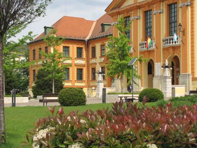
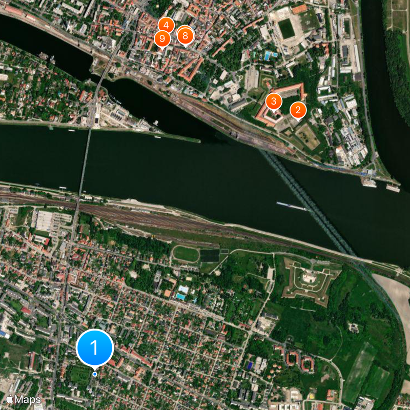
Komárom is a town on the Danube's south bank with a central railway station, industrial zones, and dense networks connecting to surrounding regions. Multiple bridges span the river, linking this Hungarian section to the Slovak side across the water.

The original city was divided by the Treaty of Trianon in 1920, with the northern section becoming present-day Komárno in Slovakia. This split along the Danube shaped the development of both settlements as separate communities.

The city displays a blend of Hungarian and Slovak influences in its street names, shops, and local customs that reflect daily life on both sides. People regularly cross the bridges to visit family and friends, making these connections part of the town's ordinary rhythm.

The Elisabeth Bridge and Monostor Bridge connect both sides and are accessible to pedestrians and vehicles crossing between the two territories. Regular train services link the town to Budapest and Bratislava, making travel straightforward for those using public transportation.

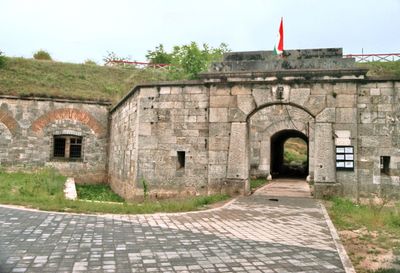
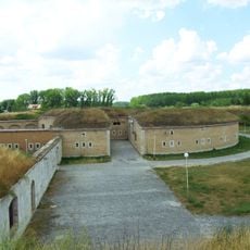
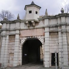
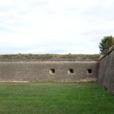
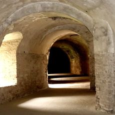
Fort Monostor, built between 1850 and 1871, remains one of Central Europe's largest preserved military fortification systems with multiple connected defensive structures. Parts of the fortress can still be explored today, offering views of both riverbanks.

Location: Komárom District

Elevation above the sea: 110 m

Part of: Komorn

Shares border with: Komárno, Iža, Almásfüzitő, Naszály, Mocsa, Csém, Ács, Zlatná na Ostrove

Website: http://komarom.hu

GPS coordinates: 47.74000,18.12167

Latest update: December 20, 2025 11:58

Photos
Reviews

Visited this place? Tap the stars to rate it and share your experience / photos with the community! Try now! You can cancel it anytime.

« Komárom - Border town on the Danube River, Hungary » is provided by Around Us (aroundus.com). Images and texts are derived from Wikimedia project under a Creative Commons license. You are allowed to copy, distribute, and modify copies of this page, under the conditions set by the license, as long as this note is clearly visible.

Discover hidden gems everywhere you go!

From secret cafés to breathtaking viewpoints, skip the crowded tourist spots and find places that match your style. Our app makes it easy with voice search, smart filtering, route optimization, and insider tips from travelers worldwide. Download now for the complete mobile experience.

Around Us App Screenshot

A unique approach to discovering new places

Le Figaro

All the places worth exploring

France Info

A tailor-made excursion in just a few clicks

20 Minutes