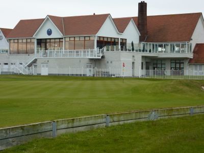
The Royal Dublin Golf Club, Golf course on Bull Island, Dublin, Ireland
The Royal Dublin Golf Club is an 18-hole links course on Bull Island, a narrow strip of coastal land in Dublin Bay, Ireland. The holes run across naturally rolling ground shaped by sand dunes, with bunkers and greens fully exposed to the sea wind.
The club was founded in 1885 and moved to Bull Island in 1889, receiving its royal title shortly after. That move shaped everything about how the course plays and feels today.
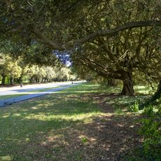
The course sits within a nature reserve, and golfers regularly encounter coastal birds and wildlife between holes. This closeness to nature shapes the experience in a way that sets it apart from an ordinary course.
The course is on Bull Island and easy to reach from central Dublin, but advance booking is required. Coastal weather changes quickly here, so layered clothing and waterproof gear are worth bringing regardless of the forecast.
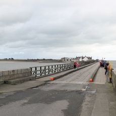
The final hole crosses a strip of land that is officially protected for nature conservation, an arrangement that required special permission from the relevant authorities. Very few golf courses anywhere in the world share their ground with a protected reserve in this direct and literal way.
The community of curious travelers
AroundUs brings together thousands of curated places, local tips, and hidden gems, enriched daily by 60,000 contributors worldwide.