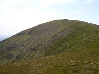
Knockmealdown, Mountain summit in County Waterford, Ireland.
Knockmealdown is a mountain summit in County Waterford, southeast Ireland, forming the natural boundary between Waterford and County Tipperary along its ridge. It is the highest point in the Knockmealdown Mountains, a range that runs roughly east to west across the region.
The Knockmealdown range has been crossed by travellers and traders for centuries, with old routes linking the lowlands of Waterford to the plains of Tipperary through the mountain passes. The Irish name of the peak appears in early written sources, pointing to how long this landscape has carried a fixed identity in the local memory.
The name Knockmealdown comes from the Irish "Cnoc Maol Donn", meaning "the brown bald hill", a description that still fits what you see when you look up at its rounded, treeless top. On clear days, walkers from Tipperary and Waterford alike treat the summit as a shared local landmark, crossing a county boundary that runs right along the ridge.
The most common starting point for reaching the summit is the road at The Vee, a mountain pass on the southern side of the range that offers parking and a clear path upward. The terrain is open and exposed, so solid boots and waterproof layers are worth bringing regardless of how the weather looks at the start.
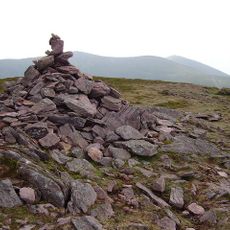
The 18th-century landowner Samuel Grubb is said to have been buried upright on the summit at his own request, so he could keep watch over his estate below for eternity. His grave is still visible near the top, making the summit an unusual stop for walkers who happen to notice it.
The community of curious travelers
AroundUs brings together thousands of curated places, local tips, and hidden gems, enriched daily by 60,000 contributors worldwide.