Chest opened
+${chestReward.xp} XP
Explorer
NOUVEAU ×${chestReward.collectible.quantity}
tapez pour fermer
Chest locked

Open chests in the app

Around Us is built for your phone — chests unlock when you walk, explore and capture nearby places.

Enable Location

We need your location to show you interesting places around you

Discover nearby places

Find interesting locations and hidden gems around you

Precise directions

Get accurate directions and distances to places

Your location is never shared with other users. It's only used when you tap the location button.

Log in to your account

Start exploring — it's free

Trusted by 72,878 travelers worldwide

Continue with Google
Continue with Apple
or

We will send you a code to connect

By continuing, you accept our Terms and Conditions and our Privacy Policy

Check your inbox

We've sent a pincode in your inbox. Please enter the code below.

Highway 20
Discussion Reviews Photo
18.9k Popularity

Highway 20, intracity freeway in Israel

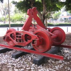
Highway 20, also known as the Ayalon Highway, is a multi-lane controlled-access road running through Tel Aviv for about 18 miles (29 km). It connects the north and south of the city and runs alongside the Ayalon River in some sections, with railway tracks integrated between the lanes.

The concept for the highway emerged in the 1950s, with the first section opening in 1982 and the complete route finished in 1991. It solved a problem created by two separate train stations and enabled the first continuous rail connection from north to south through Tel Aviv.

The road carries about 600,000 vehicles daily and is heavily congested during rush hours, so avoiding peak times is advisable. With multiple exits to different neighborhoods and integrated rail options, it offers flexible transportation choices for travelers heading to various parts of the city or other destinations.

A distinctive feature is the integration of railway tracks between the vehicle lanes, designed to reduce public transport needs. Additionally, the project included a concrete channel for flood control of the Ayalon River, addressing two infrastructure challenges in one solution.

The community of curious travelers

AroundUs brings together thousands of curated places, local tips, and hidden gems, enriched daily by 60,000 contributors worldwide.

Start exploring
Creator
Ayalon Highways
GPS coordinates
32.03750,34.76444
Latest update
February 16, 2026 23:20
Reviews
Share your experience

No review yet

Discussions
Start a discussion...

No discussion yet

« Highway 20 - intracity freeway in Israel » is provided by Around Us (aroundus.com). Images and texts are derived from Wikimedia project under a Creative Commons license. You are allowed to copy, distribute, and modify copies of this page, under the conditions set by the license, as long as this note is clearly visible.

Discover hidden gems everywhere you go!

From secret cafés to breathtaking viewpoints, skip the crowded tourist spots and find places that match your style. Our app makes it easy with voice search, smart filtering, route optimization, and insider tips from travelers worldwide. Download now for the complete mobile experience.

Around Us App Screenshot

A unique approach to discovering new places

Le Figaro

All the places worth exploring

France Info

A tailor-made excursion in just a few clicks

20 Minutes

Around Us
Travel Guide & Maps
Download

Send to your phone

QR Code
1

Open the camera app on your mobile.

2

Point at the QR code with your camera. A notification will appear.

3

Tap the notification to open the link.