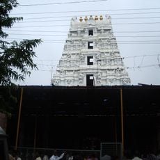
Prakasam district, Administrative district in Andhra Pradesh, India
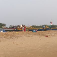
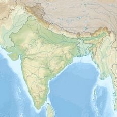
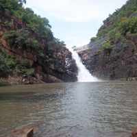
Prakasam is an administrative division in the coastal Andhra region that stretches between Bapatla district to the north and Nellore district to the south. The landscape ranges from coastal plains along the Bay of Bengal to hilly terrain in the western part.
The administrative unit was formed on February 2, 1970, by merging territories from Guntur, Nellore, and Kurnool, with Ongole chosen as its headquarters. Boundaries shifted several times over the decades to improve regional development.
The area takes its name from freedom fighter Tanguturi Prakasam Pantulu and preserves farming methods passed down through generations. Local weavers produce handmade fabrics that appear in markets alongside fresh vegetables and spices.
National Highway 16 and National Highway 216 pass through the area, connecting it to other parts of Andhra Pradesh. The railway station in Ongole offers connections to larger cities such as Vijayawada and Chennai.
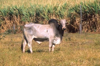
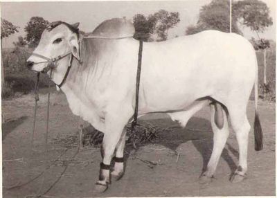
The region is home to the Ongole cattle breed, known for its strength and size. Chimakurthi has major granite deposits, while Markapur produces slate products used across the country.
Location: Andhra Pradesh
Inception: February 2, 1970
Capital city: Ongole
Shares border with: Mahabubnagar district, Sri Potti Sri Ramulu Nellore district, YSR district, Guntur district
Website: http://prakasam.ap.nic.in
GPS coordinates: 15.50000,80.05000
Latest update: December 13, 2025 16:31
Mallikarjuna Temple
141.8 kmNagarjunsagar-Srisailam Tiger Reserve
133.9 km
Kotappakonda
72 km
Kondaveedu Fort
87.7 km
Mallela Theertham
153.6 kmBhairavakona
101.9 km
Chandavaram Buddhist site
82.3 kmGangamma Temple, Dhenuvakonda
24.6 km
Bhairavakonda Caves
102 kmGanga Parvathi sametha Nageswaraswamy temple
90.7 km
Ramayapatnam Lighthouse
50.1 km
Kotta palem
41.7 kmPedaganjam mound
26.2 kmPitikeswara Temples
99.6 kmPusalapadu ancient site
101.4 kmRamalingesvara temple group
115.3 kmChennakesava Swamy temple
551 mKanuparti mounds
19.7 kmSrisailam Reservoir
139.7 kmInscribed marble pillar at Ipuru
86.4 kmCumbum Tank
104.4 kmPhaladara Panchadara
138.6 kmJupalli Center
80.6 kmSri Srinivasa Cement
80.8 kmStatue
82 kmMallavaram Dam Boating Point
19.3 kmView point Bheemuni kolanu భీముని కొలను
138.3 kmGM Engineering works
80.8 kmVisited this place? Tap the stars to rate it and share your experience / photos with the community! Try now! You can cancel it anytime.
Hanumanthuni Padu mandal
Santhanuthala Padu mandal
Veligandla mandal
Racherla mandal
Yerragondapalem mandal
Mundlamuru mandal
Marripudi mandal
Maddipadu mandal
Bestawaripeta mandal
Ponnaluru mandal
Peda Araveedu mandal
Pedacherlo Palle mandal
Pullalacheruvu mandal
Naguluppala Padu mandal
Dornala mandal
Donakonda mandal
Darsi mandal
Tripuranthakam mandal
Thallur mandal
Tarlupadu mandal
Tangutur mandal
Zarugumilli mandal
Kurichedu mandal
Ardhaveedu mandal
Singarayakonda mandal
Pamur mandal
Cumbum mandal
Giddalur mandal
Ongole mandal
Podili mandal
Kanigiri mandal
Markapur mandal
Chimakurthi mandal
Chandra Sekhara Puram mandal
Komarolu mandal
Konakanamitla mandal
Kotha Patnam mandal
Kondapi mandal
Discover hidden gems everywhere you go!
From secret cafés to breathtaking viewpoints, skip the crowded tourist spots and find places that match your style. Our app makes it easy with voice search, smart filtering, route optimization, and insider tips from travelers worldwide. Download now for the complete mobile experience.
A unique approach to discovering new places❞
— Le Figaro
All the places worth exploring❞
— France Info
A tailor-made excursion in just a few clicks❞
— 20 Minutes