Enable Location

We need your location to show you interesting places around you

Discover nearby places

Find interesting locations and hidden gems around you

Precise directions

Get accurate directions and distances to places

Your location is never shared with other users. It's only used when you tap the location button.

Madhubani district

Log in to your account

Start exploring — it's free

Trusted by 61,980 travelers worldwide

Continue with Google
Continue with Apple
or

We will send you a code to connect

By continuing, you accept our Terms and Conditions and our Privacy Policy

Check your inbox

We've sent a pincode in your inbox. Please enter the code below.

Madhubani district

Madhubani district, Administrative district in Bihar, India.

Madhubani district is an administrative area in northeastern Bihar bordering Nepal and organized into five administrative subdivisions. The territory is divided into twenty-one local blocks that form its administrative structure.

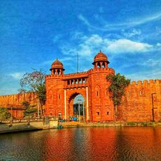
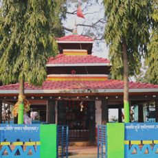
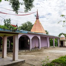
The district was separated from Darbhanga in 1972 and gained its own administrative status. The archaeological site of Baliraajgadh indicates the region's earlier importance during the Mithila Kingdom period.

Women throughout the region create traditional paintings with geometric patterns and natural pigments, a craft passed down through generations. This art form shapes daily life and appears in homes and public spaces across the district.

The district connects to Nepal through Laukaha town, establishing a trade route to the Nepalese settlement of Thadi. This link facilitates commerce and movement between the two regions.

In 2019 a meteorite landed on farmland and was later named by scientists who studied it. The discovery provided insights into space material and continues to interest researchers.

The community of curious travelers

AroundUs brings together thousands of curated places, local tips, and hidden gems, enriched daily by 60,000 contributors worldwide.

Start exploring
Capital city
Madhubani
Shares border with
Sitamarhi district, Darbhanga district, Supaul district
GPS coordinates
26.35000,86.08000
Latest update
December 14, 2025 20:40
« Madhubani district - Administrative district in Bihar, India » is provided by Around Us (aroundus.com). Images and texts are derived from Wikimedia project under a Creative Commons license. You are allowed to copy, distribute, and modify copies of this page, under the conditions set by the license, as long as this note is clearly visible.

Discover hidden gems everywhere you go!

From secret cafés to breathtaking viewpoints, skip the crowded tourist spots and find places that match your style. Our app makes it easy with voice search, smart filtering, route optimization, and insider tips from travelers worldwide. Download now for the complete mobile experience.

Around Us App Screenshot

A unique approach to discovering new places

Le Figaro

All the places worth exploring

France Info

A tailor-made excursion in just a few clicks

20 Minutes

Around Us
Travel Guide & Maps
Download

Send to your phone

QR Code
1

Open the camera app on your mobile.

2

Point at the QR code with your camera. A notification will appear.

3

Tap the notification to open the link.