Enable Location

We need your location to show you interesting places around you

Discover nearby places

Find interesting locations and hidden gems around you

Precise directions

Get accurate directions and distances to places

Your location is never shared with other users. It's only used when you tap the location button.

Vijaypura District

Log in to your account

Start exploring — it's free

Trusted by 62,474 travelers worldwide

Continue with Google
Continue with Apple
or

We will send you a code to connect

By continuing, you accept our Terms and Conditions and our Privacy Policy

Check your inbox

We've sent a pincode in your inbox. Please enter the code below.

Vijaypura District

Vijaypura District, Administrative district in Karnataka, India

Vijaypura District is an administrative area in Karnataka consisting mostly of flat agricultural terrain and managed from the city that shares its name. The territory includes numerous villages and settlements connected by a network of roads and smaller routes.

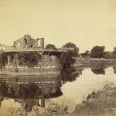
The administrative unit was formed in 1848 under British rule and went through several territorial reorganizations during the 20th century. After Indian independence, the territory shifted between different states before being finally assigned to Karnataka in 1973.

The region takes its name from the city that was once known as Bijapur before being renamed Vijaypura in recent decades. Many residents across the area speak Kannada alongside other languages and maintain traditions tied closely to rural life and farming cycles.

Travelers will find accommodations and basic services such as markets and medical facilities in Vijayapura city and larger towns throughout the district. The climate is warm and dry for most of the year, so comfortable clothing and plenty of drinking water are important during any exploration.

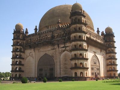
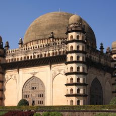
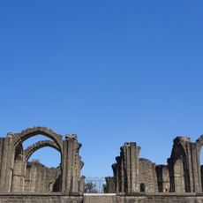
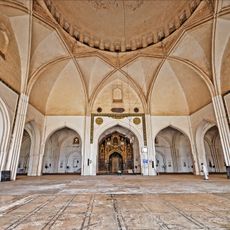
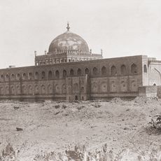
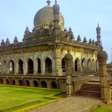
Within its boundaries lies a monument with one of the largest unsupported domes anywhere in the world, now among the most visited structures in the region. The acoustics beneath this dome allow a whisper on one side to be clearly heard on the opposite side.

The community of curious travelers

AroundUs brings together thousands of curated places, local tips, and hidden gems, enriched daily by 60,000 contributors worldwide.

Start exploring
Location
Inception
1848
Capital city
Vijayapura
Shares border with
Sangli district, Raichur district
GPS coordinates
16.82000,75.72000
Latest update
December 13, 2025 17:28
« Vijaypura District - Administrative district in Karnataka, India » is provided by Around Us (aroundus.com). Images and texts are derived from Wikimedia project under a Creative Commons license. You are allowed to copy, distribute, and modify copies of this page, under the conditions set by the license, as long as this note is clearly visible.

Discover hidden gems everywhere you go!

From secret cafés to breathtaking viewpoints, skip the crowded tourist spots and find places that match your style. Our app makes it easy with voice search, smart filtering, route optimization, and insider tips from travelers worldwide. Download now for the complete mobile experience.

Around Us App Screenshot

A unique approach to discovering new places

Le Figaro

All the places worth exploring

France Info

A tailor-made excursion in just a few clicks

20 Minutes

Around Us
Travel Guide & Maps
Download

Send to your phone

QR Code
1

Open the camera app on your mobile.

2

Point at the QR code with your camera. A notification will appear.

3

Tap the notification to open the link.