Enable Location

We need your location to show you interesting places around you

Discover nearby places

Find interesting locations and hidden gems around you

Precise directions

Get accurate directions and distances to places

Your location is never shared with other users. It's only used when you tap the location button.

Bagalkot district

Log in to your account

Start exploring — it's free

Trusted by 61,557 travelers worldwide

Continue with Google
Continue with Apple
or

We will send you a code to connect

By continuing, you accept our Terms and Conditions and our Privacy Policy

Check your inbox

We've sent a pincode in your inbox. Please enter the code below.

Bagalkot district

Bagalkot district, Administrative district in Karnataka, India

Description

Bagalkot is an administrative district in North Karnataka spread across the plateau region with ten administrative subdivisions. The area sits at about 524 meters elevation and encompasses varied landscapes and communities.

History

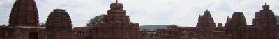
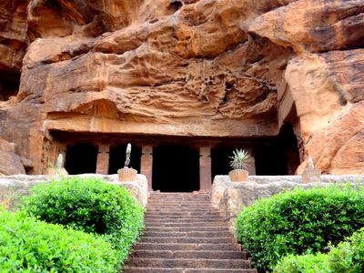
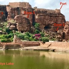
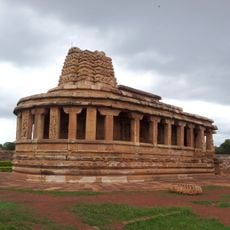
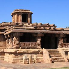
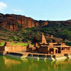
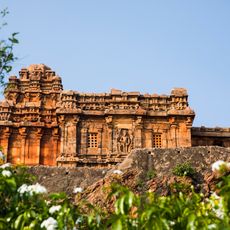
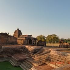
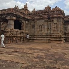
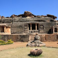
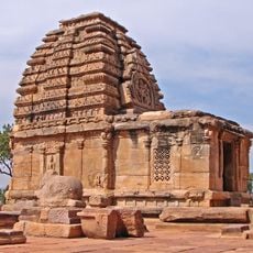
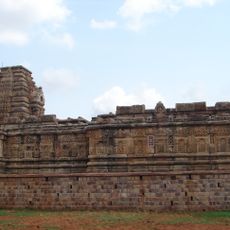
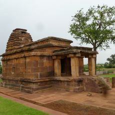
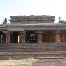
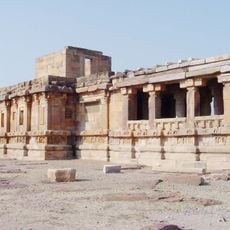
The district became independent in 1997 when it separated from Vijayapura, yet its roots reach back to the 6th century when it was a center of the Chalukyan Empire. This long history has left marks on the region's landscape and character.

Culture

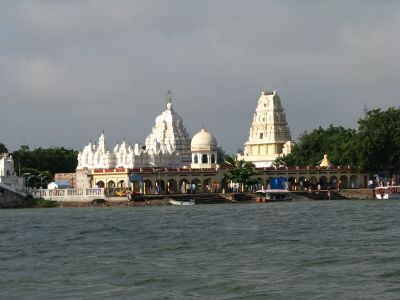
Three rivers cross through the region - Krishna, Ghataprabha, and Malaprabha - meeting at Kudalasangama, which holds deep spiritual meaning for local communities. This convergence has shaped the way people connect with the land and their traditions.

Practical

The economy is mainly shaped by agriculture, with farmers growing cotton, jowar, groundnut, and tobacco in nutrient-rich black soil. Visitors can experience the rural way of life and farming practices that define daily activities across the region.

Did you know?

Ancient stone inscriptions suggest the area was once called Bagadige, a name that local tradition credits to Ravana as a gift to his musicians. This mythological connection gives the place a story that locals still share today.

Location
Inception
1997
Capital city
Bagalkot
Elevation above the sea
524 m
Shares border with
Vijaypura District, Koppal district
GPS coordinates
16.16944,75.69167
Latest update
December 14, 2025 18:16

AroundUs brings together thousands of curated places, local tips, and hidden gems, enriched daily by 60,000 contributors worldwide. Discover all places nearby (Belgaum division).

« Bagalkot district - Administrative district in Karnataka, India » is provided by Around Us (aroundus.com). Images and texts are derived from Wikimedia project under a Creative Commons license. You are allowed to copy, distribute, and modify copies of this page, under the conditions set by the license, as long as this note is clearly visible.

Discover hidden gems everywhere you go!

From secret cafés to breathtaking viewpoints, skip the crowded tourist spots and find places that match your style. Our app makes it easy with voice search, smart filtering, route optimization, and insider tips from travelers worldwide. Download now for the complete mobile experience.

Around Us App Screenshot

A unique approach to discovering new places

Le Figaro

All the places worth exploring

France Info

A tailor-made excursion in just a few clicks

20 Minutes

Around Us
Travel Guide & Maps
Download

Send to your phone

QR Code
1

Open the camera app on your mobile.

2

Point at the QR code with your camera. A notification will appear.

3

Tap the notification to open the link.