Raiganj community development block, Administrative block in Raiganj subdivision, India
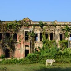
Raiganj community development block is an administrative unit in West Bengal spanning several hundred square kilometers across more than 200 villages. The region has electrical infrastructure and farmland that form the backbone of the local economy.
This administrative unit was created in 1992 as part of a reorganization of local governance structures in West Bengal. Its formation was part of a broader process to decentralize administration and improve local management across the state.
The block reflects the diversity of its residents, with people from different social backgrounds living and working together across the villages. This mixture shapes daily life and the relationships that form within rural communities.
The area is accessible through various transport connections, including bus routes and ferry services that link villages and settlements. Multiple transportation options make it possible to travel through different parts of the region.
The region is managed through a system of village councils that handle local affairs directly, involving communities in decisions that affect them. This decentralized approach allows each village to set its own priorities.
Location: Raiganj subdivision
Inception: April 1992
Shares border with: Kaliaganj community development block, Hemtabad community development block, Itahar community development block, Karandighi community development block
GPS coordinates: 25.62000,88.12000
Latest update: December 11, 2025 18:02
Adina Mosque
52.2 km
Gor-E-Shahid Eidgah Maidan
51.4 km
Bangarh
47.2 km
Ramsagar National Park
37.4 km
Adina Deer Park
53.6 km
Jamalpur Jame Masjid
50.4 km
Dargah of Shah Ata
48 kmGovernment Girls' High School, Dinajpur
51.9 km
Singra National Park
53.6 km
Dinajpur Museum
51.8 km
Bahin Zamindar bari
8.3 km
Pirpal Dargah
45.5 km
Poragachhi temple
53.3 km
Mohanta masjid
2.9 km
Tarasundari temple
22.7 km
Durgadalan of Bhupalpur Rajbari
9.6 km
Bhairabi temple
17.4 km
Bhupalpur Rajbari
9.6 km
Mahurkismat Pancharatna temple
46.8 km
Pirpukurer Dargah
1.4 km
Panchamukhi Shiva Temple
30 km
Pramatheshwar Mahadevjiu temple
29.4 km
Thakurdalan of Zamindar house of Bandopadhyay family
51.6 km
Kardaha Shiva temple
51.5 km
Zamindar house of Bandopadhyay family
51.6 km
Shibbari solitary pillar
47.6 km
Site of Usha and Aniruddha's Marriage
47.6 km
Mahipaldighi Neelkuthi
38 kmVisited this place? Tap the stars to rate it and share your experience / photos with the community! Try now! You can cancel it anytime.
Discover hidden gems everywhere you go!
From secret cafés to breathtaking viewpoints, skip the crowded tourist spots and find places that match your style. Our app makes it easy with voice search, smart filtering, route optimization, and insider tips from travelers worldwide. Download now for the complete mobile experience.
A unique approach to discovering new places❞
— Le Figaro
All the places worth exploring❞
— France Info
A tailor-made excursion in just a few clicks❞
— 20 Minutes