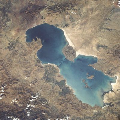
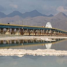
Urmia Lake, Salt lake in northwestern Iran.
Urmia Lake stretches between East Azerbaijan and West Azerbaijan provinces and receives water from several rivers in a closed drainage basin. Its water surface changes with the seasons and the shores show white salt crusts that stand out in the sunlight.
Archaeological excavations around the body of water suggest that people settled here and practiced farming as early as eight thousand years ago. Later, different Persian dynasties controlled the region and used it as a trade route between Mesopotamia and the Caspian Sea.
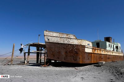
The name derives from the Persian word for water and coastal residents use the surrounding land for orchards and vineyards fed by tributary streams. Small fishing communities make their living from salt trade and dried algae, which serve as traditional remedies.
The best time to visit is in spring when snowmelt raises the water level and shoreline vegetation turns green. In summer the water level drops noticeably and salt deposits extend further inland.
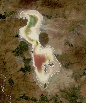
When the water level is low, islands form that serve as resting places for migratory birds before they continue south or north. Some of these islands show reddish colors from bacteria that can survive in extremely salty water.
The community of curious travelers
AroundUs brings together thousands of curated places, local tips, and hidden gems, enriched daily by 60,000 contributors worldwide.