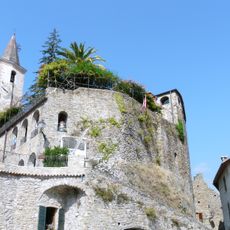
Apricale, Medieval village in Nervia Valley, Liguria, Italy
Apricale is a commune in the province of Imperia, located on a hillside with traditional stone buildings and narrow winding streets. The layout creates a network of passages between clustered houses with arched doorways, where alleyways connect different levels of the settlement.
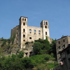
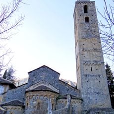
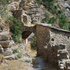
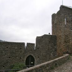
The settlement originated in the medieval period as a fortified outpost in the Nervia Valley to protect regional trade routes. A castle with towers was built during this era and continues to define the village profile today.
The village maintains its medieval character through narrow lanes and stone buildings where locals go about their daily routines. You will notice how residents use the small squares as gathering places and keep their homes decorated with flowers and traditional details.
The village sits on a hillside and is best explored on foot, as the narrow streets are not suitable for vehicles once inside. Wear comfortable shoes with good grip, as the terrain includes steep sections and uneven stone surfaces throughout the settlement.
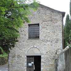
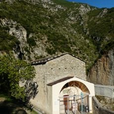
The village church holds wall paintings from previous centuries that show religious art traditions of the region. Parts of these frescoes are partially visible from outside as you walk through the narrow passages.
Location: Province of Imperia
Capital city: Apricale
Elevation above the sea: 291 m
Shares border with: Bajardo, Dolceacqua, Isolabona, Perinaldo, Pigna, Rocchetta Nervina, Sanremo, Castel Vittorio
Address: 18035 Apricale, Province of Imperia, Italy
Website: https://comune.apricale.im.it
GPS coordinates: 43.88053,7.66048
Latest update: December 6, 2025 16:02
Liguria stretches as a narrow coastal strip between the Maritime Alps and the Apennines, combining maritime tradition with mountainous interior. Along the Riviera di Ponente in the west lie towns such as Dolceacqua with its medieval Doria Castle, the fortified town of Noli, and the Hanbury Botanical...
Doria castle in Dolceacqua
4.3 km
Monte Bignone
5.9 km
Parco naturale regionale delle Alpi Liguri
14.4 km
Castello della Lucertola
57 m
Monte Toraggio
10.6 km
Monte Ceppo
10.2 km
San Michele Arcangelo
5.9 km
Borghetto Viaduct
8.9 km
V Settore di Copertura Media Roja
14.6 km
Sant'Antonio Abate
4.4 km
I Settore di Copertura Bassa Roja
9.8 km
San Bernardo
5.9 km
Église de la Madone del Poggio
14.3 km
Church Sancta-Maria-in-Albis
13.4 km
Sasso Viaduct
9.3 km
Palazzo dei monaci
6.7 km
Pinacoteca Rambaldi
9.4 km
Porte d'Italie
13.1 km
Chapelle Saint-Antoine-l'Ermite de Breil-sur-Roya
13.1 km
Chapelle Sainte-Catherine de Breil-sur-Roya
13.1 km
Église Saint-Marc de Piène-Haute
11.9 km
San Giorgio
4.8 km
Chapelle des Pénitents blancs de Piène-Haute
12 km
Medieval bridge on the Nervia
4.4 km
Polyptych of Santa Devota
4.5 km
Torre Saracena
8.2 km
Castello dei Doria
1.6 km
Chapelle de la Miséricorde des Pénitents noirs de Breil-sur-Roya
13.4 kmVisited this place? Tap the stars to rate it and share your experience / photos with the community! Try now! You can cancel it anytime.
Discover hidden gems everywhere you go!
From secret cafés to breathtaking viewpoints, skip the crowded tourist spots and find places that match your style. Our app makes it easy with voice search, smart filtering, route optimization, and insider tips from travelers worldwide. Download now for the complete mobile experience.
A unique approach to discovering new places❞
— Le Figaro
All the places worth exploring❞
— France Info
A tailor-made excursion in just a few clicks❞
— 20 Minutes