Enable Location

We need your location to show you interesting places around you

Discover nearby places

Find interesting locations and hidden gems around you

Precise directions

Get accurate directions and distances to places

Your location is never shared with other users. It's only used when you tap the location button.

Favara

Log in to your account

Start exploring — it's free

Trusted by 62,161 travelers worldwide

Continue with Google
Continue with Apple
or

We will send you a code to connect

By continuing, you accept our Terms and Conditions and our Privacy Policy

Check your inbox

We've sent a pincode in your inbox. Please enter the code below.

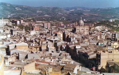
Favara, Sicilian commune in Province of Agrigento, Italy

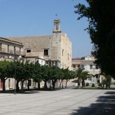
Favara is a commune in the Province of Agrigento, located on the slope of Monte Caltafaraci at an elevation of 338 meters (1,110 feet). The settlement spreads across 80 square kilometers of Mediterranean landscape.

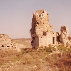
Early human presence dates back to the late copper age, roughly 2400 to 1990 BC, with red pottery discovered in local caves showing ancient settlement. Later, the Chiaramonte Castle rose in the late 13th century, becoming a defining feature of the medieval period.

During Easter, locals prepare traditional pastries shaped like lambs, made with locally grown almonds and pistachios passed down through family recipes. These sweets remain an important part of how the community celebrates the season.

The town sits on a sloped hillside and is easily reached by car or local transport through standard roads. Visitors should wear comfortable footwear as the terrain is uneven and walking can be steep in some areas.

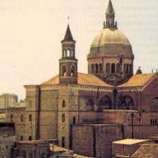
The Chiaramonte Castle features Norman architectural elements from its late medieval construction that set it apart from other Sicilian fortifications. The remaining structure reveals how defenders built walls and fortifications during that era.

The community of curious travelers

AroundUs brings together thousands of curated places, local tips, and hidden gems, enriched daily by 60,000 contributors worldwide.

Start exploring
Elevation above the sea
338 m
Shares border with
Aragona, Comitini, Grotte, Racalmuto, Agrigento, Castrofilippo, Naro
GPS coordinates
37.31861,13.66306
Latest update
December 17, 2025 11:17
« Favara - Sicilian commune in Province of Agrigento, Italy » is provided by Around Us (aroundus.com). Images and texts are derived from Wikimedia project under a Creative Commons license. You are allowed to copy, distribute, and modify copies of this page, under the conditions set by the license, as long as this note is clearly visible.

Discover hidden gems everywhere you go!

From secret cafés to breathtaking viewpoints, skip the crowded tourist spots and find places that match your style. Our app makes it easy with voice search, smart filtering, route optimization, and insider tips from travelers worldwide. Download now for the complete mobile experience.

Around Us App Screenshot

A unique approach to discovering new places

Le Figaro

All the places worth exploring

France Info

A tailor-made excursion in just a few clicks

20 Minutes

Around Us
Travel Guide & Maps
Download

Send to your phone

QR Code
1

Open the camera app on your mobile.

2

Point at the QR code with your camera. A notification will appear.

3

Tap the notification to open the link.