Piazza d'Armi of Turin, Public park and former military grounds in Turin, Italy
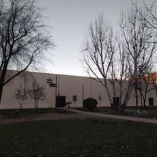
Piazza d'Armi of Turin is now the Parco Cavalieri di Vittorio Veneto, a green area in the Santa Rita district. Its quadrilateral is slightly trapezoidal, not rectangular: the shorter sides face east-west along the decumanus, the longer sides north-south along the cardo. A 2,152-metre fence encloses it, and inside lies Campo Porcelli, an army athletics ground with a riding track.
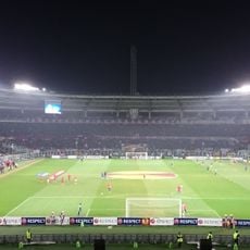
Turin's parade ground moved several times with the city's growth: a site near corso Matteotti from 1817, then between corso Galileo Ferraris and corso Montevecchio from 1872, and finally to the Santa Rita area in 1910. Around the new ground rose the La Marmora, Dabormida, Morelli di Popolo and Riberi barracks, and in 1933 the Stadio Municipale. Military use faded and the area became the parco Cavalieri di Vittorio Veneto, with further work for the 2006 Winter Olympics.
Locals still call the green area "Piazza d'Armi" even though it has been named Parco Cavalieri di Vittorio Veneto since the late 1970s; before that it was nicknamed "parco dell'Eliporto" after the Aldo Cavallo heliport operating there from 1958 to 1971. Its fenced quadrilateral, 2,152 metres of railing, is a training ground for middle-distance runners and joggers, mostly amateurs.
The park has multiple entry points connecting to surrounding streets, making it easy to access from different directions. The flat and open layout works well for various activities, whether you prefer walking paths or open training areas.
The perimeter fence of the park measures 2,152 metres, and the enclosure is not a true rectangle but slightly trapezoidal, with its short sides aligned east-west and its long sides north-south. From 1958 to 1971 a heliport named after Aldo Cavallo operated here, which is why the area was long called Parco dell'Eliporto.
The community of curious travelers
AroundUs brings together thousands of curated places, local tips, and hidden gems, enriched daily by 95,359 contributors worldwide.