Monte Canda, Mountain summit in Emilia-Romagna, Italy.
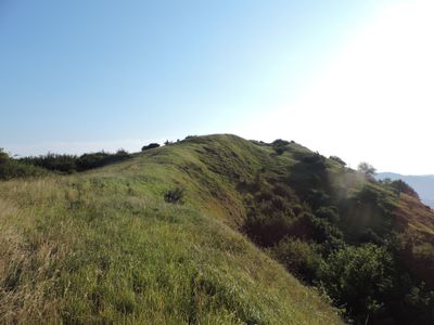
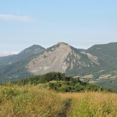
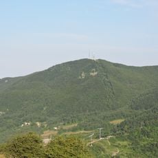
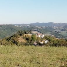
Monte Canda is a mountain reaching 1,158 meters in elevation, part of the northern Apennine chain in Emilia-Romagna. The peak connects different valleys and serves as a natural dividing line between nearby regions.
Medieval merchants and travelers used the mountain paths around the peak as key trade routes connecting different Italian regions. These passages shaped how the area developed and how people still move through it today.
Local herders use the slopes for moving livestock between seasonal grazing grounds, a practice that still shapes village life around the mountain.
Climbing requires proper hiking gear and starts from nearby villages, with best conditions from April through October. You should expect changing weather and start early to have enough daylight for a safe return.
The peak sits at the intersection of three regional territories, making it a natural boundary marker visible from several surrounding valleys. This position makes it a notable landmark that helps orient visitors across the broader landscape.
Elevation above the sea: 1,158 m
GPS coordinates: 44.17520,11.35390
Latest update: December 14, 2025 20:01
Sasso di San Zanobi
3.5 km
San Giovanni Battista
6.6 km
Palazzo Loup
10.4 km
Monte Beni
3.9 km
Monte Oggioli
3 km
San Giovanni Decollato
8.5 km
San Benedetto
10.6 km
Palazzo Pretorio
6.6 km
Monument to the Fallen of Covigliaio
6 km
Chiesa di San Giovanni Battista di Scanello
10.5 km
San Gregorio Magno Church
9.5 km
Museum of Pietra Serena
6.6 km
San Michele (Montalbano, Firenzuola)
2.5 km
Chiesa di Santa Maria
7.4 km
Sant’Andrea Apostolo
7.5 km
Church of st.Justin and the beheading of St. John the Baptists
8.5 km
Osservatorio astronomico di Loiano
9.2 km
Chiesa della Beata Vergine del Rosario e di San Lorenzo
4.4 km
Chiesa di San Paolo
8.6 km
Madonna della Neve Sanctuary
8 km
San Biagio Church
6.6 km
Monument to the Fallen of Firenzuola
6.4 km
San Domenico e Giustino (San Pellegrino)
8.9 km
Montalbano tombstone
2.5 km
Cappella ed ex cimitero
10.5 km
Memorial stone to the fallen of Pietramala
1.9 km
Portico del santuario
6.7 km
Ca' di Bastiano
9.5 kmVisited this place? Tap the stars to rate it and share your experience / photos with the community! Try now! You can cancel it anytime.
Discover hidden gems everywhere you go!
From secret cafés to breathtaking viewpoints, skip the crowded tourist spots and find places that match your style. Our app makes it easy with voice search, smart filtering, route optimization, and insider tips from travelers worldwide. Download now for the complete mobile experience.
A unique approach to discovering new places❞
— Le Figaro
All the places worth exploring❞
— France Info
A tailor-made excursion in just a few clicks❞
— 20 Minutes