Monte Castelfraiano, Mountain summit in Emilia-Romagna, Italy
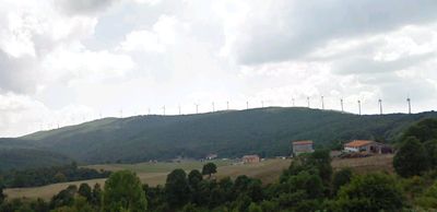
Monte Castelfraiano is a mountain summit in the Apennine range that rises to about 1,415 meters (4,640 feet) and can be reached by multiple hiking paths. The routes pass through grasslands, forests, and rocky sections with varying difficulty levels.
The mountain has shaped settlement patterns throughout the centuries, acting as a natural dividing line between communities. Its height and visibility made it an important landmark for navigation and territorial reference in the surrounding landscape.
The mountain holds an important place in how local communities view and navigate their region. People from nearby villages often mention it as a reference point and incorporate it into their outdoor traditions.
The summit is accessible via marked trails that start from several villages and entry points scattered around the base. Summer and early autumn are the best seasons for a comfortable hike with stable weather and clear visibility.
The mountain supports distinct plant communities at each elevation level due to microclimates created by its position. Walking from base to summit, visitors move through noticeably different environments as temperature and conditions shift.
The community of curious travelers
AroundUs brings together thousands of curated places, local tips, and hidden gems, enriched daily by 60,000 contributors worldwide.