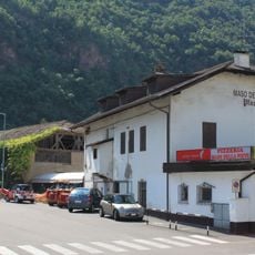
Monte Pozza, Mountain summit in South Tyrol, Italy
Monte Pozza, called Titschen in German, is a 1,615 m mountain closing the south side of Bolzano. Its summit is reached by an easy trail climbing from the south-west, while the wooded slope above Colle di Villa (Bauernkohlern, 1,138 m) is ringed by a wide path through the Schneiderwiesen meadows, part of the European E5 route. A lower rock spur, the Virgolo, overlooks the city centre.
The name Kohlern, recorded as early as 1270 with Conradus de Culle, comes from charcoal burning: wood from the mountain was turned into charcoal for Bolzano. In 1560 the mountain itself appears as "auf dem Tütschen", then a supplier of timber for the city's bridges. The Italian name Monte Pozza dates from the Fascist-era Italianisation of the 20th century.
The mountain carries two names: Titschen in German and Monte Pozza in Italian, reflecting South Tyrol's bilingual identity. This dual language presence shapes how locals and visitors experience and refer to the place.
The summit is reached on foot: from Colle di Villa (1,138 m) a wide forest path via Schneiderwiesen circles the peak, part of it on the European E5 trail, and a path from the south-west climbs to the top in just under two hours. A narrow asphalt road from the Colle cable-car valley station serves Colle di Villa; forest roads approach from Nova Ponente and trails from Cascata in Val d'Ega.
The mountain's Italian name, Monte Pozza, dates from the Fascist period's Italianization; the German name Titschen is attested in 1560 as "auf dem Tütschen", when the slopes supplied timber for Bolzano's bridges. Locals often call the whole mountain Colle, though that name properly belongs only to the two hamlets Herrenkohlern and Bauernkohlern on its northern side.
The community of curious travelers
AroundUs brings together thousands of curated places, local tips, and hidden gems, enriched daily by 93,998 contributors worldwide.