Pizzoc, Mountain summit in Fregona, Veneto, Italy
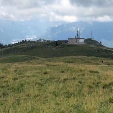
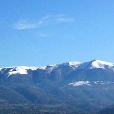
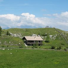
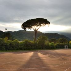
Pizzoc is a mountain in the Treviso Prealps reaching 1,565 m, the highest point of the comune of Fregona. Its summit holds the Piazza della Pace, a belvedere, and pastures with casère; a road from near La Crosetta on the SS 422 ends by the Rifugio Città di Vittorio Veneto. The northern slopes drop steeply toward the Marca Trevigiana.
The summit's name appears in a 1348 document as P i ç o c u m, later as P i z o c o in 1748 and P i z z o c c o in 1795. During the Cold War a radar control base was built on the top from 1962, linked to a launch site in Pian del Cansiglio; it closed in July 1977 and was abandoned on 21 August 1979.
The name Pizzoc comes from a pre-Latin root meaning "small point", recorded as Pizocum in a 1348 map and Pizzocco in 1795. Since 1962 the summit has hosted Piazza della Pace, a belvedere beside the former Cold War radar base, abandoned on 21 August 1979.
The summit can be reached by car: from Vittorio Veneto take the SS 422, and about 500 m past La Crosetta a road branches left to within a few metres of the top, near Rifugio Città di Vittorio Veneto. On foot, the Direttissima trail leaves from the Sonego dam at Fregona and reaches the refuge in about an hour; other routes start from Colle di Sant'Augusta above Vittorio Veneto and from Cadolten via the Sentiero del Tenente Berry.
On the summit stands Piazza della Pace, a belvedere beside the radar base built from 1962 during the Cold War and linked to a launch site in Pian del Cansiglio. It closed operationally in July 1977 and was abandoned on 21 August 1979; the flat top also serves as a passage for migrating passerine birds.
The community of curious travelers
AroundUs brings together thousands of curated places, local tips, and hidden gems, enriched daily by 94,034 contributors worldwide.