Chest opened
+${chestReward.xp} XP
Explorer
NOUVEAU ×${chestReward.collectible.quantity}
tapez pour fermer
Chest locked

Open chests in the app

Around Us is built for your phone — chests unlock when you walk, explore and capture nearby places.

Enable Location

We need your location to show you interesting places around you

Discover nearby places

Find interesting locations and hidden gems around you

Precise directions

Get accurate directions and distances to places

Your location is never shared with other users. It's only used when you tap the location button.

Okinoerabujima

Log in to your account

Start exploring — it's free

Trusted by 72,889 travelers worldwide

Continue with Google
Continue with Apple
or

We will send you a code to connect

By continuing, you accept our Terms and Conditions and our Privacy Policy

Check your inbox

We've sent a pincode in your inbox. Please enter the code below.

Okinoerabujima
Discussion Reviews 3 Photos
96.7k Popularity

Okinoerabujima, Subtropical island in Kagoshima Prefecture, Japan

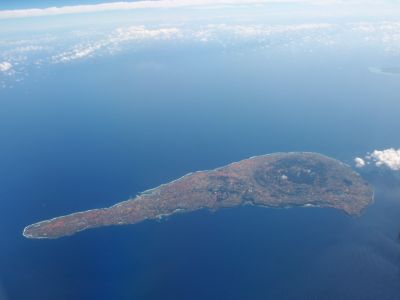
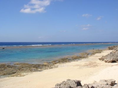
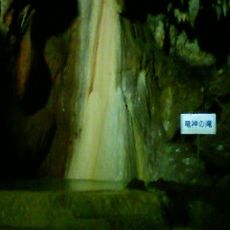
Okinoerabujima is an island in Oshima District, Kagoshima Prefecture, covering roughly 94 square kilometers and ringed by coral reefs. Below ground, branching limestone caves stretch through much of the terrain, while white sand beaches line many sections of the coast.

The island belonged to the Hokuzan kingdom starting in 1266, before joining the Ryukyu Kingdom in 1422. Samurai from the Satsuma Domain conquered the area in 1609 and brought it under their control.

The Aji nobility constructed numerous gusuku fortifications across the island, establishing a hierarchical social structure that influenced local governance.

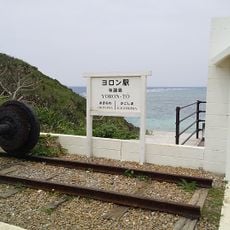
Flights from Kagoshima Airport reach Okinoerabu Airport, while ferries run regularly from Amami Oshima and Okinawa. Visitors can use bicycles or rental cars to explore the coastal roads and villages.

The waters around the island are exceptionally clear, allowing sunlight to penetrate down to roughly 30 meters (about 100 feet). This light nourishes extensive coral colonies that spread across wide areas of the seabed.

The community of curious travelers

AroundUs brings together thousands of curated places, local tips, and hidden gems, enriched daily by 60,000 contributors worldwide.

Start exploring
Location
Elevation above the sea
240 m
Part of
Amami Islands
GPS coordinates
27.36889,128.56667
Latest update
December 12, 2025 23:39
Reviews
Share your experience

No review yet

Discussions
Start a discussion...

No discussion yet

« Okinoerabujima - Subtropical island in Kagoshima Prefecture, Japan » is provided by Around Us (aroundus.com). Images and texts are derived from Wikimedia project under a Creative Commons license. You are allowed to copy, distribute, and modify copies of this page, under the conditions set by the license, as long as this note is clearly visible.

Discover hidden gems everywhere you go!

From secret cafés to breathtaking viewpoints, skip the crowded tourist spots and find places that match your style. Our app makes it easy with voice search, smart filtering, route optimization, and insider tips from travelers worldwide. Download now for the complete mobile experience.

Around Us App Screenshot

A unique approach to discovering new places

Le Figaro

All the places worth exploring

France Info

A tailor-made excursion in just a few clicks

20 Minutes

Around Us
Travel Guide & Maps
Download

Send to your phone

QR Code
1

Open the camera app on your mobile.

2

Point at the QR code with your camera. A notification will appear.

3

Tap the notification to open the link.