Chest opened
+${chestReward.xp} XP
Explorer
NOUVEAU ×${chestReward.collectible.quantity}
tapez pour fermer
Chest locked

Open chests in the app

Around Us is built for your phone — chests unlock when you walk, explore and capture nearby places.

Enable Location

We need your location to show you interesting places around you

Discover nearby places

Find interesting locations and hidden gems around you

Precise directions

Get accurate directions and distances to places

Your location is never shared with other users. It's only used when you tap the location button.

Kunashir Island

Log in to your account

Start exploring — it's free

Trusted by 72,926 travelers worldwide

Continue with Google
Continue with Apple
or

We will send you a code to connect

By continuing, you accept our Terms and Conditions and our Privacy Policy

Check your inbox

We've sent a pincode in your inbox. Please enter the code below.

Kunashir Island
Discussion Reviews 2 Photos
144k Popularity

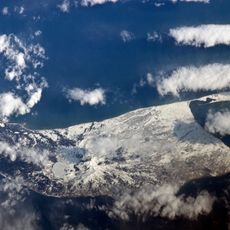
Kunashir Island, Volcanic island in Kuril Islands, Russia and Japan

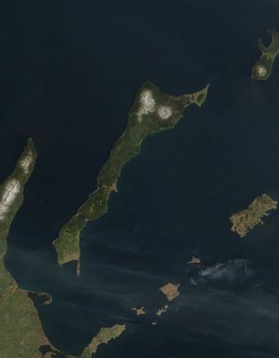
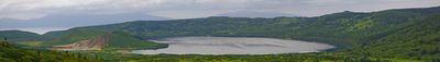
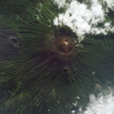
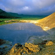
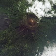
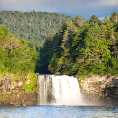
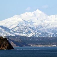
Kunashir is a volcanic island in the southernmost part of the Kuril chain, stretching about 76 miles (123 km) between the Pacific Ocean and the Sea of Okhotsk. Four merged volcanoes dominate the landscape, with lakes, sulfurous springs, and coniferous forests of spruce and fir filling the spaces between the peaks.

The Soviet Union occupied the island in September 1945 after the end of World War II and expelled the Japanese population. Sovereignty over the island remains unresolved between Russia and Japan, preventing a formal peace treaty between the two countries.

The island's name comes from an Ainu word meaning black island, referring to its dark volcanic slopes visible from the sea. Fishermen from Hokkaido still consider the waters around it part of their traditional fishing grounds, although access remains restricted.

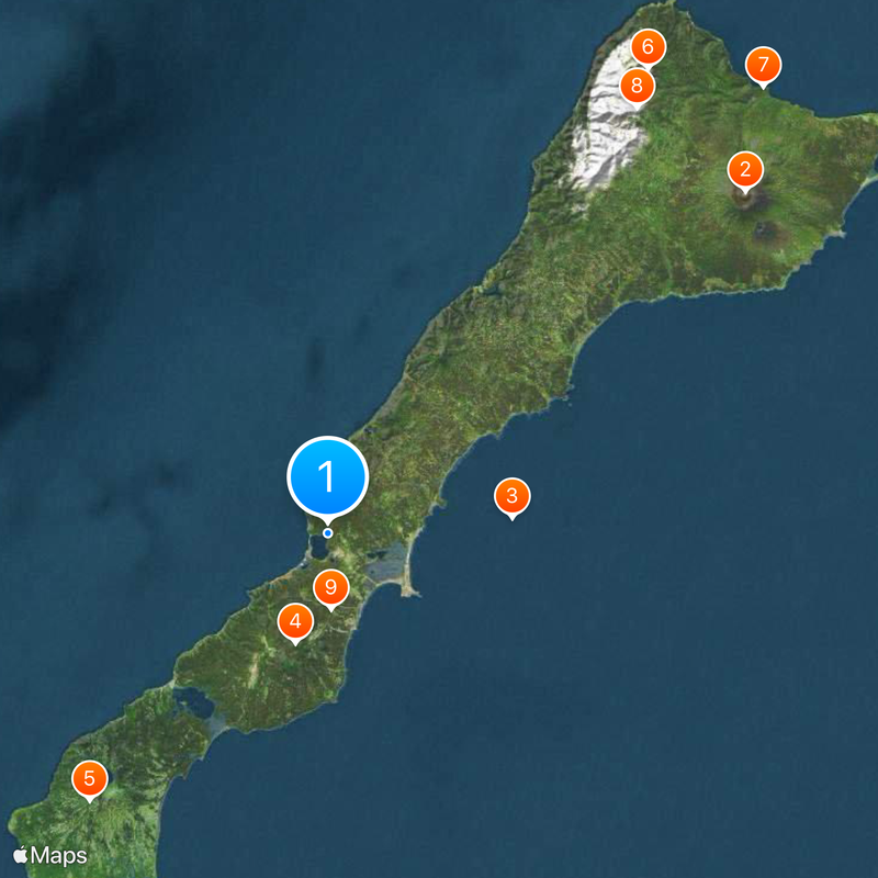
Travelers reach Yuzhno-Kurilsk, the main settlement with around 7,800 residents, by air or ferry from Sakhalin Island. Warm clothing and sturdy footwear are necessary due to the cool climate and muddy trails near the hot springs.

The Mendeleevskaya plant harnesses underground heat from the active volcanoes to generate electricity for nearby settlements. Visitors can see wild bamboo forests growing near the thermal springs, a rare sight at this northern latitude.

The community of curious travelers

AroundUs brings together thousands of curated places, local tips, and hidden gems, enriched daily by 60,000 contributors worldwide.

Start exploring
Location
Kunashiri district
Capital city
Yuzhno-Kurilsk
Elevation above the sea
1,819 m
Part of
Greater Kuril Ridge
GPS coordinates
44.07000,145.77000
Latest update
March 5, 2026 18:58
Around this place
Tyatya
Japan

Tyatya

49.8 km
Kurils Nature Reserve
Russian Federation

Kurils Nature Reserve

17.1 km
Mendeleyeva
Russian Federation

Mendeleyeva

10.5 km
Golovnin
Russian Federation

Golovnin

33 km
Ruruidake
Russian Federation

Ruruidake

52 km
Ptichy Waterfall
Russian Federation

Ptichy Waterfall

57.5 km
Smirnov
Russian Federation

Smirnov

48.4 km
Russian Federation

Место для парковки, разворота

7 km
Russian Federation

Произрастание группы Тисов

6.7 km
Russian Federation

Дюна

7.6 km
Russian Federation

Тисовая роща

7.6 km
Russian Federation

Произрастание Кедрового стланника( сосны стелящаяся)

6.9 km
Russian Federation

9-й км- начало маршрута на источник Росинка, на Верхне-докторские источники, на водопады( пороги) Кислого ручья

6.2 km
Russian Federation

Огромные Тисы, Коллапанакс и Ель

7.6 km
Russian Federation

Кекур «Чёртов палец»

8.4 km
Russian Federation

Автопарковка, место разворота

6.6 km
Russian Federation

Выход на тропу к Верхне- докторским источникам

7.5 km
Russian Federation

Обход по петле разбитого участка дороги

7.2 km
Russian Federation

Cape Stolbchatyy

9 km
Russian Federation

Bear’s beach

2.1 km
Russian Federation

Остатки японской фабрики по переработке серы

31.5 km
Russian Federation

Кекурк одинокий

9 km
Russian Federation

Начало пути ( найти в бамбучнике)

7.5 km
Russian Federation

Lake Kipyashcheye

31.5 km
Russian Federation

Термальные источники Столбовские

9.9 km
Russian Federation

Северо-западное сульфатарное поле

9.8 km
Russian Federation

Ванночки Чайка

21.1 km
Russian Federation

Место причала лодки

48.6 km
Show the full map
Reviews
Share your experience

No review yet

Discussions
Start a discussion...

No discussion yet

« Kunashir Island - Volcanic island in Kuril Islands, Russia and Japan » is provided by Around Us (aroundus.com). Images and texts are derived from Wikimedia project under a Creative Commons license. You are allowed to copy, distribute, and modify copies of this page, under the conditions set by the license, as long as this note is clearly visible.

Discover hidden gems everywhere you go!

From secret cafés to breathtaking viewpoints, skip the crowded tourist spots and find places that match your style. Our app makes it easy with voice search, smart filtering, route optimization, and insider tips from travelers worldwide. Download now for the complete mobile experience.

Around Us App Screenshot

A unique approach to discovering new places

Le Figaro

All the places worth exploring

France Info

A tailor-made excursion in just a few clicks

20 Minutes

Around Us
Travel Guide & Maps
Download

Send to your phone

QR Code
1

Open the camera app on your mobile.

2

Point at the QR code with your camera. A notification will appear.

3

Tap the notification to open the link.