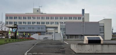
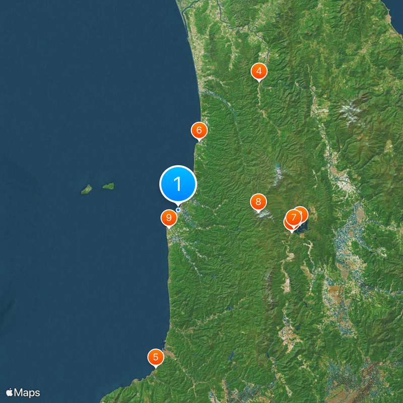
Haboro, Coastal town in Rumoi Subprefecture, Japan
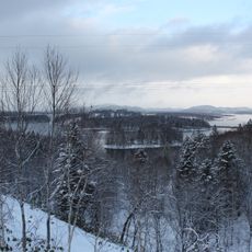
Haboro is a coastal town in Rumoi Subprefecture situated along the Sea of Japan and surrounded by the Teshio Mountains. The municipality also encompasses two inhabited islands, Yagishiri and Teuri, as part of its territory.
The town grew significantly between 1940 and 1970 due to coal mining operations that shaped the local economy. This industrial period left a lasting impact on the community's development and structure.
The name comes from the Ainu language, referring to either soft sounds or a river basin. Visitors can sense this connection to indigenous heritage through the local geography and how the community identifies with its natural surroundings.
Visitors can reach the town by car using National Route 232 or take daily bus services from nearby cities. The warmer months offer the most comfortable conditions for exploring the coastal and mountainous areas.
Mount Pisshiri rises to 1,032 meters within the town boundaries and creates a natural divide between the coastal and inland regions. This geographical feature shapes the landscape and defines distinct zones within the community.
Location: Rumoi Subprefecture
Location: Tomamae district
Inception: April 1, 1902
Shares border with: Tomamae, Shosanbetsu, Embetsu, Horokanai
Website: https://town.haboro.lg.jp
GPS coordinates: 44.36056,141.69728
Latest update: December 6, 2025 22:07
Kamuikotan
80.8 km
Lake Shumarinai
40.9 km
Shiokari Pass Museum
74.6 km
Kōken-ji
38.5 km
Yasushi Inoue Memorial Hall
81.6 km
Nayoro City Museum
61.3 km
Arashiyama Park
79.5 km
Nayoro Municipal Observatory Kitasubaru
62.5 km
北留萌消防組合
475 m
Sheep and cloud hill
57 km
Fukagawa-nishi toll gate
81.3 km
Kembuchichoehonnoyakata
60.7 km
Haboro Port
1.7 km
上川北部消防事務組合
60.4 km
Teuri Port
30.6 km
Mashike Port
57.9 km
Asahi sunrise hall
76.6 km
Yagishiri Port
23.2 km
近文大橋
80.5 km
Soshin-no-matsu
55.6 km
Moseushi Town Curling Hall
76.2 km
夫婦岩
72.4 km
近藤重蔵ゆかりの地
74.2 km
Sankebetsu brown bear incident
26.5 km
Shosanbetsu observatory
24.2 km
Shumarinai Prefectural Natural Park
39 km
Mashike Lighthouse
57.9 km
Torokko Okoku Bifuka
72.4 kmVisited this place? Tap the stars to rate it and share your experience / photos with the community! Try now! You can cancel it anytime.
Discover hidden gems everywhere you go!
From secret cafés to breathtaking viewpoints, skip the crowded tourist spots and find places that match your style. Our app makes it easy with voice search, smart filtering, route optimization, and insider tips from travelers worldwide. Download now for the complete mobile experience.
A unique approach to discovering new places❞
— Le Figaro
All the places worth exploring❞
— France Info
A tailor-made excursion in just a few clicks❞
— 20 Minutes