Mount Kyō, Mountain summit in Nagano Prefecture, Japan
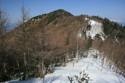
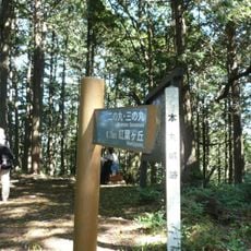
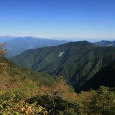
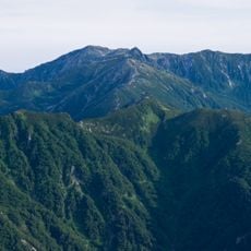
Mount Kyō is a summit at the northern end of the Kiso mountain range in Nagano Prefecture, marking a clear boundary between the range and the surrounding highlands. Several hiking routes lead to the top, passing through forest zones and open alpine terrain.
The Kiso range, of which this peak is a part, was shaped by the same tectonic forces that built the Japanese Alps over a very long period. The valleys at its foot were once traveled by people walking the old Nakasendo road, one of the main routes linking the old capitals of Japan.
The name "Kyō" connects the mountain to the idea of a capital or sacred center, a word once used in Japan to describe places of high spiritual standing. Locals in the Kiso valley have long looked to this peak as a natural landmark that marks the edge of their world.
The mountain is most accessible between July and October, when the snow has melted and the trails are in good condition. Weather at the summit can shift quickly, so warm layers and rain gear are worth bringing even on a clear morning.
The summit sits on the old provincial boundary between Shinano and Mino, two historic regions that had distinct identities and administrations for centuries. This means the peak was once a natural border marker, something that still gives it a particular place on old Japanese maps.
The community of curious travelers
AroundUs brings together thousands of curated places, local tips, and hidden gems, enriched daily by 60,000 contributors worldwide.