Geospatial Information Authority of Japan, National mapping agency in Tsukuba, Japan
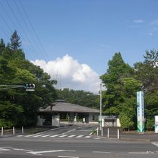
The Geospatial Information Authority of Japan is a government facility in Tsukuba that employs 671 staff to conduct surveys and collect geographic data of the country. The main building contains laboratories, data rooms, and a public museum about the history of mapmaking.
The institution was founded in 1869 as the Geographical Survey Institute and received its current name in March 2010. The renaming brought new responsibilities for monitoring seismic activity.
The museum on the premises shows how Japanese surveyors have mapped the territory over centuries. Visitors see historical tools alongside modern instruments still in use today.
The museum is open to the public on weekdays and offers free admission. Digital maps of the entire Japanese archipelago can be downloaded from the official website.
A reference point from 1891 sets the zero elevation for all measurements in the country. This point is located near Tokyo central station and serves as the foundation for all Japanese elevation data.
The community of curious travelers
AroundUs brings together thousands of curated places, local tips, and hidden gems, enriched daily by 60,000 contributors worldwide.