Okdolbong, Berggipfel in Südkorea
Location: North Gyeongsang
GPS coordinates: 37.02250,128.78250
Latest update: October 28, 2025 10:57

Muryangsujeon
8.8 km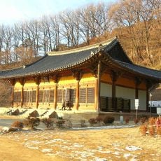
Buseoksa
8.8 km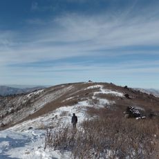
Taebaeksan National Park
15.9 km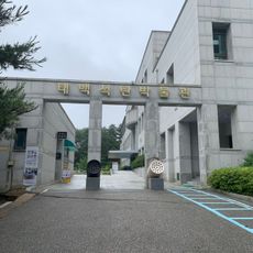
Taebaek Coal Museum
18.3 km
송이 동상
15.3 km
장승
15.3 km
후토스촬영장
13 km
김삿갓문학관
17.3 km
1177갱
18 km
꽃그림 벽화
15.4 km
김삿갓(병현)묘역
17.5 km
Bird hide, scenic viewpoint
13.4 km
Scenic viewpoint
14.7 km
은어 동상
15.2 km
후토스촬영장
13 km
봉화워터파크
15 km
경로당 정자
15.4 km
송이
15.5 km
송이
15.4 km
법전정자
15 km
척곡2리마을쉼터
15.9 km
孝忠傳家(효충전가)
16 km
충혼탑
15.1 km
은어동상
15.9 km
송이테마동상
15.8 km
고치령비석
17.2 km
태백산비석
14.5 km
경찰관순직비
17.3 kmReviews
Visited this place? Tap the stars to rate it and share your experience / photos with the community! Try now! You can cancel it anytime.
Discover hidden gems everywhere you go!
From secret cafés to breathtaking viewpoints, skip the crowded tourist spots and find places that match your style. Our app makes it easy with voice search, smart filtering, route optimization, and insider tips from travelers worldwide. Download now for the complete mobile experience.

A unique approach to discovering new places❞
— Le Figaro
All the places worth exploring❞
— France Info
A tailor-made excursion in just a few clicks❞
— 20 Minutes