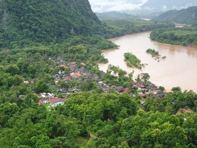
Muang Ngoi Neua, Remote village near Nam Ou River, Laos.
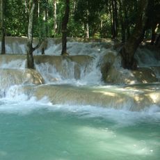
Muang Ngoi Neua is a settlement situated along the Nam Ou River in northern Laos, surrounded by limestone hills and thick forests. Houses are scattered along the riverbanks, creating a linear village layout with water as the main axis.
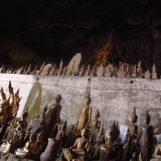
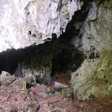
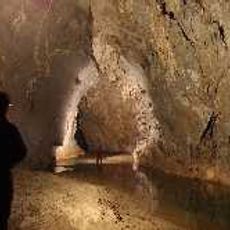
During the Laotian Civil War, this place served as a refuge for inhabitants who sheltered in nearby caves during bombardments. The conflict left deep marks on the village, shaping its recovery and development in the decades that followed.
The community here relies on fishing and rice farming as the main ways of life, with local practices shaped by the river and seasons. You can see this daily rhythm in how people move through the village and use the water and surrounding land.
The village is accessible only by boat from Nong Khiaw downstream, with no road connections to reach it. Electricity is limited throughout the settlement, so bring a flashlight and plan activities around daylight hours.
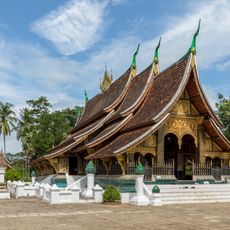
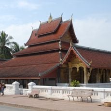
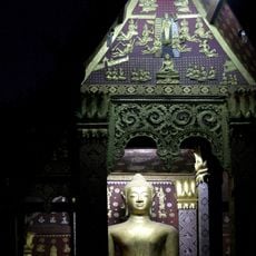
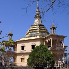
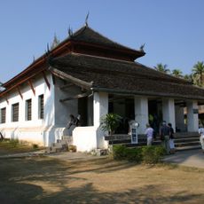
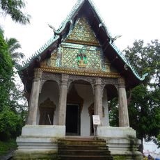
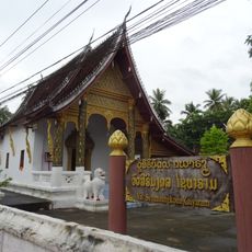
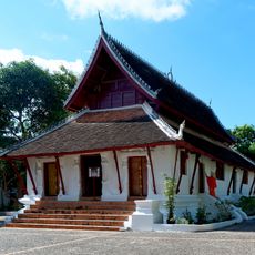
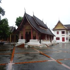
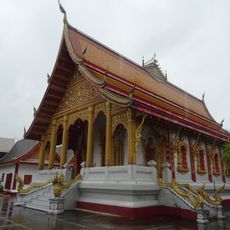
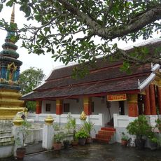
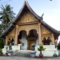
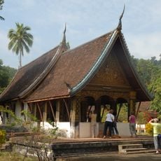
The village once had three Buddhist temples before wartime destruction claimed most of them. Wat Okad temple was rebuilt in the 1970s and remains a visible reminder of the community's resilience.
GPS coordinates: 20.70900,102.67500
Latest update: December 6, 2025 17:43
Laos features a mix of Buddhist temples, waterfalls, and caves that shape the country's character. Temple complexes such as Wat Xieng Thong in Luang Prabang and Vat Phou in Champasak display religious art and architecture spanning different periods. Natural areas showcase powerful waterfalls like...
Wat Xieng Thong
106 km
Royal Palace, Luang Prabang
107 km
Pak Ou Caves
88 km
Tam Pa Ling Cave
94.7 km
Night Market
107.1 km
Wat Mai Suwannaphumaham
107.1 km
Wat Sen
106.3 km
Tat Sae Waterfalls
107.4 km
Wat Phol Phao
107.7 km
Vat Visounarath
107.3 km
Chom Ong
84.4 km
Wat Pa Huak
107 km
Wat Mahathat
107.6 km
Wat Syrimoungkoun Xaiyaram
106.2 km
Wat Pak Khan
106 km
Wat Suwanna Khili
106.1 km
Vat Nong Sikhounmuang
106.4 km
Wat Sop Sickharam
106.2 km
Vat Choum Khong
106.8 km
Đồi D1
84.1 km
Wat Long Koon
105.8 km
Wat Aham
107.3 kmHat Pok
86.4 kmHat On
89.8 kmHat Kipo
95.1 kmHat Kha (lapyahan, lat 21,43, long 102,35)
87.1 km
Wat Phonxay Sanasongkham
107.3 kmHat Kimpahan
94.2 kmVisited this place? Tap the stars to rate it and share your experience / photos with the community! Try now! You can cancel it anytime.
Discover hidden gems everywhere you go!
From secret cafés to breathtaking viewpoints, skip the crowded tourist spots and find places that match your style. Our app makes it easy with voice search, smart filtering, route optimization, and insider tips from travelers worldwide. Download now for the complete mobile experience.
A unique approach to discovering new places❞
— Le Figaro
All the places worth exploring❞
— France Info
A tailor-made excursion in just a few clicks❞
— 20 Minutes